Moulsecoomb
Introduction
The photograph on this page of Moulsecoomb by Simon Carey as part of the Geograph project.
The Geograph project started in 2005 with the aim of publishing, organising and preserving representative images for every square kilometre of Great Britain, Ireland and the Isle of Man.

There are currently over 7.5m images from over 14,400 individuals and you can help contribute to the project by visiting https://www.geograph.org.uk
Moulsecoomb
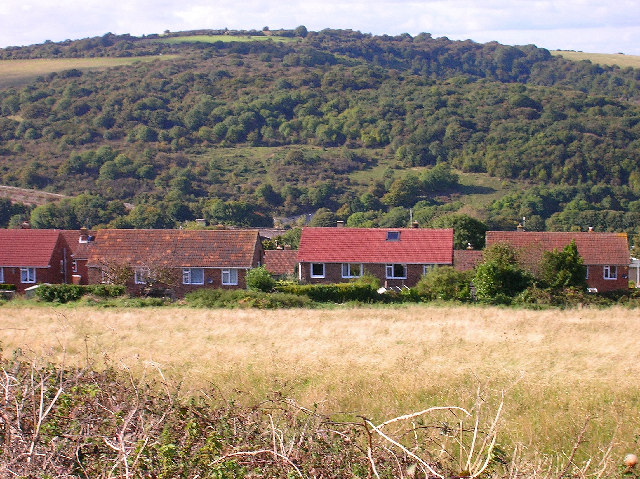
Image: © Simon Carey Taken: 9 Oct 2005
Taken from the Downs looking west. Moulsecoomb was built in the 1930s to house those removed slum clearances within the city. Between the two houses in the middle the railway bridge over the A270 can be made out. Beyond that is Moulsecoomb Wild Park.
Images are licensed for reuse under creativecommons.org/licenses/by-sa/2.0
Image Location


Leaflet Map data © OpenStreetMap
Latitude
50.850814
Longitude
-0.110579