
IMAGES TAKEN NEAR TO
Rattle Road, PEVENSEY, BN24 5DH
Introduction
This page details the photographs taken nearby to Rattle Road, BN24 5DH by members of the Geograph project.
The Geograph project started in 2005 with the aim of publishing, organising and preserving representative images for every square kilometre of Great Britain, Ireland and the Isle of Man.

There are currently over 7.5m images from over14,400 individuals and you can help contribute to the project by visiting https://www.geograph.org.uk
Image Map
Images are licensed for reuse under creativecommons.org/licenses/by-sa/2.0
Notes
- Clicking on the map will re-center to the selected point.
- The higher the marker number, the further away the image location is from the centre of the postcode.
Image Listing (18 Images Found)
Images are licensed for reuse under creativecommons.org/licenses/by-sa/2.0
Image
Details
Distance
1
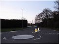
Gallows Lane
Taken from the junction with Rattle Road. The lane leads to Mill Hill then beyond to Hankham. As the name suggests the higher ground was the site of the old gallows which would have been viewable from the road below.
Image: © Simon Carey
Taken: 21 Mar 2010
0.04 miles
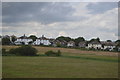
3
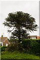
Monkey Puzzle Tree, Rattle road, Westham
Image: © Julian P Guffogg
Taken: 24 May 2014
0.10 miles
6
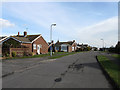
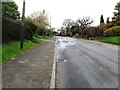
Castle View Gardens
An estate of bungalows built in the 1950s on what was once Barrack Field which was the location for a set of barracks during the Napoleonic Wars.
Image: © Simon Carey
Taken: 20 Feb 2010
0.15 miles
7
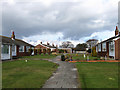
Bungalows, Castle View Gardens
A housing estate built in the 1950s on what was once Barrack Field which itself was named after a set of barracks located here during the Napoleonic Wars.
Image: © Simon Carey
Taken: 20 Feb 2010
0.18 miles
8
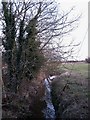
Rattle Stream
Small stream that rise near Peelings Lane before heading south onto Mountney Level.
Image: © Simon Carey
Taken: 21 Mar 2010
0.18 miles
9
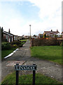
Linkway
The name of the path on which the bungalows beyond are located. The path runs through a centre of a small estate built in the 1950s on what was once Barrack Field which was the location of a barracks during the Napoleonic Wars. The path run between Castle View Gardens and St John's Drive.
Image: © Simon Carey
Taken: 20 Feb 2010
0.18 miles
10
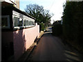
Ketcham Corner, Mill Hill, Westham
Looking south down Hankham Hall Road to the crossroads with Peelings Lane and Gallows Lane (straight ahead). The name Ketcham Corner was coined by locals when Customs and Excise men ambushed 100 smugglers bringing their contraband inshore from Pevensey to Hailsham.
Image: © Simon Carey
Taken: 21 Jan 2006
0.18 miles