1
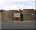
High Street, Brighton
A residential road running between St James's Street and Edward Street that was originally developed in the 1800s though next to nothing is left from that period now with the exception of the Ranelagh Arms on the left which was converted from housing into a pub sometime in the 1930s. Beyond the pub on the left is Ardingly Court and further up on that side are some 1930s council housing built to blend in within the district and are now listed. On the eastern side to the right is high rise St James's Lodge built in the 1960s and beyond the white building is Windsor Lodge erected in 1886 as a chapel but after a variety of uses has been converted to flats.
Image: © Simon Carey
Taken: 11 Oct 2015
0.02 miles
2
National Spiritualist Church, Edward Street
head north along Devonshire Place then west along Edward Street. The church is between Blaker and Grosvenor Streets and was constructed in 1964-65 to replace another in Mighell Street. The design is a figure of eight and the lack of windows on the street side give it a strange, mysterious feeling.
Click on the link to take you to the next page. http://www.geograph.org.uk/photo/231676
Image: © Simon Carey
Taken: 1 Sep 2006
0.02 miles
3
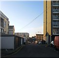
Chapel Street, Brighton
A residential road that runs between St James's Street and Edward Street that was first developed in the 1800s but has little of its original buildings remaining. On the eastern side in view the houses date from the mid 1990s, the previous ones demolished during the 1980s and then left as parking. All of the western side has been removed mainly in the 1960s to make way for St James's House another high rise block.
Image: © Simon Carey
Taken: 11 Oct 2015
0.02 miles
4
Chapel Street, Brighton
A residential road linking St James's Street with Edward Street that was originally developed in the 1800s but nothing now remains from that era. Much of the original housing was removed in the 1930s with the rest going in the 1960s. Small terraces have been rebuilt on the eastern side whilst much of the west is taken up with the high rise St James's Lodge. Tyson Place is the high rise block in the distance.
Image: © Simon Carey
Taken: 1 Nov 2015
0.02 miles
5
Chapel Street
Linking Edward Street to St James's Street. many of the small terraced houses were demolished in the 1960s to make way for the High Street development whose high rise flats are visible to the right.
Image: © Simon Carey
Taken: 7 Oct 2011
0.02 miles
6
The Little Globe, Edward Street
Head a little east up Edward Street and this building is on the southern side on the junction with Dorset Place. Originally a pub now converted into solicitors offices who have retained the facade of the previous building.
Click on the link to take you to the next page. http://www.geograph.org.uk/photo/231662
Image: © Simon Carey
Taken: 1 Sep 2006
0.04 miles
7
Devonshire Place, BN2
Image: © Mike Quinn
Taken: 22 May 2012
0.05 miles
8
Ardingly Street, Brighton
More a service road that runs from Chapel Street across High Street and ends beyond Cavendish Street. The road was created in the early 1970s when much of three streets mentioned above were demolished. On the right is part of the high rise St James's Lodge.
Image: © Simon Carey
Taken: 1 Nov 2015
0.05 miles
9
Devonshire Place, Brighton
A residential street running from St James's Street to Edward Street that was developed in the 1820s parts by well known architects Busby and Wilds. Tyson Place is the high rise in the distance.
Image: © Simon Carey
Taken: 11 Oct 2015
0.05 miles
10
72-73, High Street, Brighton
Number 72 has been home to the Brighton Women's Centre since 2006 having previously been located in the Brighthelm Centre. It was founded in 1974. Number 73 is a former beer house originally called the Hope but renamed Balaclava in the 1860s. It closed in 1914 and is now a private dwelling.
Image: © Simon Carey
Taken: 1 Nov 2015
0.05 miles


