IMAGES TAKEN NEAR TO
St. James's Street, BRIGHTON, BN2 1QG
Introduction
This page details the photographs taken nearby to St. James's Street, BN2 1QG by members of the Geograph project.
The Geograph project started in 2005 with the aim of publishing, organising and preserving representative images for every square kilometre of Great Britain, Ireland and the Isle of Man.

There are currently over 7.5m images from over14,400 individuals and you can help contribute to the project by visiting https://www.geograph.org.uk
Image Map
Images are licensed for reuse under creativecommons.org/licenses/by-sa/2.0
Notes
- Clicking on the map will re-center to the selected point.
- The higher the marker number, the further away the image location is from the centre of the postcode.
Image Listing (1006 Images Found)
Images are licensed for reuse under creativecommons.org/licenses/by-sa/2.0
Image
Details
Distance
1
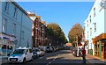
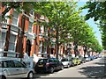
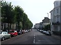
St James's Avenue, Brighton
A residential road that runs between St James's Street and Edward Street that was built in 1889 on the site of former slum housing containing Rock Mews and Rock Court.
Image: © Simon Carey
Taken: 11 Oct 2015
0.01 miles
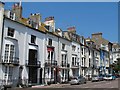
3
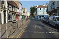
Upper Rock Gardens
Head south a little from the road junction down Upper Rock Gardens. The western side was developed from 1820 onwards while the eastern side had to wait until 1879 as the land was part of the Earl of Egremont's East Lodge Gardens.
Click on the link to take you to the next page. http://www.geograph.org.uk/photo/232067
Image: © Simon Carey
Taken: 1 Sep 2006
0.02 miles
4
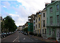
Brighton: Upper Rock Gardens
Please see Simon's Image from his excellent centisquare walkabout of TQ3104 for the history of the development of this street. St Mary's Church is on the left but behind the trees, and the sea can just be glimpsed at the bottom of Lower Rock Gardens in the distance.
Image: © Nigel Cox
Taken: 8 Jun 2008
0.02 miles
5
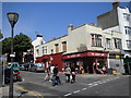
The Gossip Cafe, St James's Street, Brighton
At the junction of St James's Avenue
Image: © Robin Sones
Taken: 6 Jun 2010
0.02 miles
6
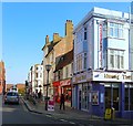
74-77, St James's Street, Brighton
Various shops, bars and restaurants occupy the space between Lower Rock Gardens and Rock Place with Muang Thai on the corner of the latter.
Image: © Simon Carey
Taken: 11 Oct 2015
0.02 miles
9
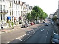
Upper Rock Gardens, Brighton
The road is a continuation of Lower Rock Gardens that heads north from Marine Parade, the A259. The west side was developed in the 1810s with the east side original containing Egremont House which faced south and possessed extensive grounds. This was demolished in the 1880s and replaced with current housing lining the street.
Image: © Simon Carey
Taken: 4 Oct 2015
0.02 miles
10
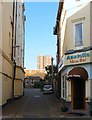
New Steine Mews, Brighton
Small cul de sac off St James's Street which was developed around the 1800s and once contained a small row of cottages and a depot.
Image: © Simon Carey
Taken: 11 Oct 2015
0.02 miles