
IMAGES TAKEN NEAR TO
St. James's Street, BRIGHTON, BN2 1PR
Introduction
This page details the photographs taken nearby to St. James's Street, BN2 1PR by members of the Geograph project.
The Geograph project started in 2005 with the aim of publishing, organising and preserving representative images for every square kilometre of Great Britain, Ireland and the Isle of Man.

There are currently over 7.5m images from over14,400 individuals and you can help contribute to the project by visiting https://www.geograph.org.uk
Image Map
Images are licensed for reuse under creativecommons.org/licenses/by-sa/2.0
Notes
- Clicking on the map will re-center to the selected point.
- The higher the marker number, the further away the image location is from the centre of the postcode.
Image Listing (859 Images Found)
Images are licensed for reuse under creativecommons.org/licenses/by-sa/2.0
Image
Details
Distance
1
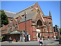
St Mary's Church, St James's Street
At the junction of Upper Rock Gardens. Taken from the junction with Lower Rock Gardens.
Image: © Robin Sones
Taken: 6 Jun 2010
0.01 miles
2
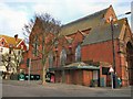
St Mary's Church, Rock Gardens
Church website: https://www.stmaryschurchbrighton.org.uk/
Image: © Paul Gillett
Taken: 2 Jan 2011
0.01 miles
3
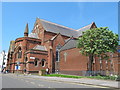
The Parish Church of St.Mary The Virgin, Kemptown
Image: © Mike Quinn
Taken: 22 May 2012
0.02 miles
4
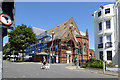
St. Mary's church under repair, Brighton
Curiously enough on St. James's Street, to the right.
Image: © Robin Webster
Taken: 19 Jul 2016
0.02 miles
5
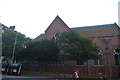
Church of St Mary the Virgin
Grade II listed. https://britishlistedbuildings.co.uk/101380884-church-of-st-mary-the-virgin-queens-park-ward
Image: © N Chadwick
Taken: 7 Jul 2018
0.02 miles
6
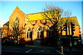
St Mary's Church, Rock Gardens
This is the side elevation of the building to the street called Upper Rock Gardens, geographically the west face but liturgically the south aisle and transept. The full dedication of the church is St Mary & St James. It was completed in 1879 to replace an earlier building, to the design of Sir William Emerson, the only English church by an architect who practised mainly in India - in the same year he was working on the cathedral of All Saints at Allahabad (Prayagraj) in Uttar Pradesh. The style has been described as a blend of Early English and Early French Gothic; note the cross gables to the aisle. Inside, the crossing, apse and shallow transepts are all vaulted. A planned tower and spire at the liturgical south-west angle, the corner of St James's Street, were never completed.
St Mary's is listed Grade II* https://britishlistedbuildings.co.uk/101380884-church-of-st-mary-the-virgin-queens-park-ward
Brighton & Hove Churches https://sussexparishchurches.org/church/brighton-and-hove-st-mary-st-jamess-street/
Image: © Tiger
Taken: 21 Jan 2020
0.02 miles
7
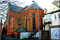
Apse of St Mary's
The apsidal sanctuary and liturgical north (geographically east) transept of Image seen from a side passage. As Nicholas Antram and Richard Morrice note in their Pevsner city guide "its red brick exterior with sandstone dressings is difficult to appreciate in its begrimed state and scruffy environs".
St Mary's is listed Grade II* https://britishlistedbuildings.co.uk/101380884-church-of-st-mary-the-virgin-queens-park-ward
Brighton & Hove Churches https://sussexparishchurches.org/church/brighton-and-hove-st-mary-st-jamess-street/
Image: © Tiger
Taken: 21 Jan 2020
0.02 miles
8
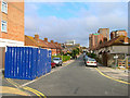
Hereford Street
Head south out of Park Street across Eastern Road then take a footpath to Hereford Street. Originally developed between 1809-21 this area was also cleared of slums between 1926-28 and rebuilt during the 1930s before being halted by the war then recommencing from the late 1950s as can be seen by the mixture of styles evident in this pcture.
This page is the last of the tour of TQ3104.
Image: © Simon Carey
Taken: 1 Sep 2006
0.02 miles
9
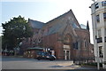
Church of St Mary the Virgin
Grade II* listed. https://britishlistedbuildings.co.uk/101380884-church-of-st-mary-the-virgin-queens-park-ward
Image: © N Chadwick
Taken: 7 Jul 2018
0.03 miles
10
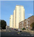
Lavender Street, Brighton
The road originally ran from Upper St James's Street to Eastern Road but since the 1960s now ends at the junction with Hereford Street. Originally developed in the 1810s the area soon became a notorious slum and began to be cleared in the late 1920s but was not completed until the 1960s. The former high density terraced housing was replaced with flats and five high rises, two of which, Wiltshire House and Hereford Court, are in view.
Image: © Simon Carey
Taken: 4 Oct 2015
0.03 miles