IMAGES TAKEN NEAR TO
Kings Avenue, EASTBOURNE, BN21 2PE
Introduction
This page details the photographs taken nearby to Kings Avenue, BN21 2PE by members of the Geograph project.
The Geograph project started in 2005 with the aim of publishing, organising and preserving representative images for every square kilometre of Great Britain, Ireland and the Isle of Man.

There are currently over 7.5m images from over14,400 individuals and you can help contribute to the project by visiting https://www.geograph.org.uk
Image Map
Images are licensed for reuse under creativecommons.org/licenses/by-sa/2.0
Notes
- Clicking on the map will re-center to the selected point.
- The higher the marker number, the further away the image location is from the centre of the postcode.
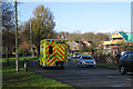
Image Listing (127 Images Found)
Images are licensed for reuse under creativecommons.org/licenses/by-sa/2.0
Image
Details
Distance
1
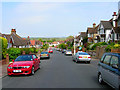
Kings Avenue, Upperton
Looking towards the A2021 and Eastbourne Level beyond.
Image: © Simon Carey
Taken: 2 Jun 2006
0.08 miles
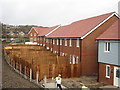
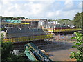
3
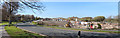
Meadows View development, King's Drive
Image: © Oast House Archive
Taken: 14 Apr 2015
0.12 miles
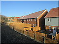
4
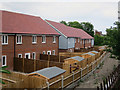
Meadows View, Eastbourne
Most of the houses are now occupied.
Image: © Oast House Archive
Taken: 25 May 2016
0.12 miles
5
Meadows View development, King's Drive
Image: © Oast House Archive
Taken: 29 Jan 2016
0.12 miles
6
Meadows View development, King's Drive
Image: © Oast House Archive
Taken: 19 Feb 2016
0.12 miles
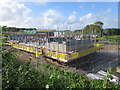
7
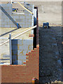
Construction detail, Meadows View development
Showing the cavity wall under construction.
Image: © Oast House Archive
Taken: 31 Jul 2015
0.13 miles
8
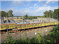
Meadows View development, Kings Drive
Image: © Oast House Archive
Taken: 14 Sep 2015
0.13 miles
9
Meadows View development, Kings Drive
Image: © Oast House Archive
Taken: 14 Sep 2015
0.13 miles
10
Meadows View development, Kings Drive
Image: © Oast House Archive
Taken: 14 Sep 2015
0.13 miles