
IMAGES TAKEN NEAR TO
Mount Pleasant, BRIGHTON, BN2 0JP
Introduction
This page details the photographs taken nearby to Mount Pleasant, BN2 0JP by members of the Geograph project.
The Geograph project started in 2005 with the aim of publishing, organising and preserving representative images for every square kilometre of Great Britain, Ireland and the Isle of Man.

There are currently over 7.5m images from over14,400 individuals and you can help contribute to the project by visiting https://www.geograph.org.uk
Image Map
Images are licensed for reuse under creativecommons.org/licenses/by-sa/2.0
Notes
- Clicking on the map will re-center to the selected point.
- The higher the marker number, the further away the image location is from the centre of the postcode.
Image Listing (355 Images Found)
Images are licensed for reuse under creativecommons.org/licenses/by-sa/2.0
Image
Details
Distance
1
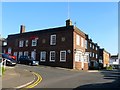
52, Carlton Hill, Brighton
Located on the corner of Marine View is the former Devonshire public house which closed around 2008, the last of the pubs in Carlton Hill which once numbered fifteen. The original pub dates from the 1840s but was rebuilt during the 1930s.
Image: © Simon Carey
Taken: 1 Nov 2015
0.02 miles
2
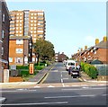
Mount Pleasant, Brighton
The road was originally laid out in the 1800s but was anything but pleasant as the area north of Edward Street and west of egremont Place soon became a slum area. The eastern side was cleared and rebuilt in the 1930s but the western side had to wait until the 1960s. St John's Mount is the block of flats on the left.
Image: © Simon Carey
Taken: 4 Oct 2015
0.02 miles
3
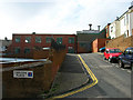
Small Factory, Marine View
Head east down Sussex Street the south down Queens Park Road then west along Park Road Terrace. A survivor of the slum clearances in this area which had started in the 1930s but only completed in the 1960s. The houses to the right are the only other survivors.
Click on the link to take you to the next page. http://www.geograph.org.uk/photo/232043
Image: © Simon Carey
Taken: 1 Sep 2006
0.02 miles
4
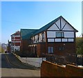
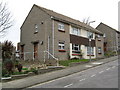
Parks View, Upper Park Place, Brighton
The flats date from the mid 1960s and were originally the rebuilt Red Lion public house which closed around ten years ago. The original pub opened in the 1850s and was rebuilt when the area was largely cleared of housing, see http://regencysociety-jamesgray.com/volume24/source/jg_24_150.html for a view of the former pub building.
Image: © Simon Carey
Taken: 1 Nov 2015
0.04 miles
6
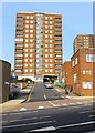
Grosvenor Street, Brighton
A cul de sac off Edward Street that was redeveloped in the 1960s having originally linked Edward Street to Carlton Hill. Tyson Place is the block of flats at the end of the street and the BYC on the building to the right stands for Brighton Youth club.
Image: © Simon Carey
Taken: 4 Oct 2015
0.05 miles
7
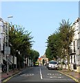
Egremont Place, Brighton
A residential road that heads north from the junction with Edward Street and Eastern Road before continuing in an arc to the west as Queen's Park Road. The road was built in the 1810s and named after Egremont House that was located on the eastern side of Upper Rock Gardens until its demolition in the 1880s.
Image: © Simon Carey
Taken: 4 Oct 2015
0.05 miles
8
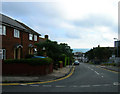
Mount Pleasant
Head south down Marine View then east along Carlton Hill. Mount Pleasant was first developed from 1800 but failed to live up to its name by becoming a notorious slum which was eventually demolished in 1935. It was rebuilt and widened to include another alley, Park Place and the eastern side was completed before the outbreak of the second world war. The war then the shortages in the aftermath meant the western side was not built until the 1960s. A theme often running in this part of the city, odd buildings and wasteland surviving from the 1930s but not fully redeveloped until the money reappeared in the 1960s.
Click on the link to take you to the next page. http://www.geograph.org.uk/photo/232047
Image: © Simon Carey
Taken: 1 Sep 2006
0.05 miles
10
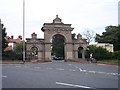
Entrance gates to Queen's Park, Brighton
Dated 1890. Viewed from the south.
Image: © Bob Embleton
Taken: 9 Sep 2005
0.05 miles