1
Chapel Street
Linking Edward Street to St James's Street. many of the small terraced houses were demolished in the 1960s to make way for the High Street development whose high rise flats are visible to the right.
Image: © Simon Carey
Taken: 7 Oct 2011
0.02 miles
2
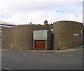
Brighton Spiritualist Church
A fair amount of money must have been spirited up for this remarkable windowless building on a prominent site. Its local rival, the Brighton and Hove Spiritualist Church, is a far humbler establishment in far humbler surroundings.
Image: © Robin Webster
Taken: 19 Jul 2016
0.03 miles
3
Blaker Street
Head west down Edward Street then north into Blaker Street. Constructed in 1898 as an early slum clearance replacing Chesterfield and Street and Derby Place. The other street in this square that I once lived in and is certainly more colourful since I was last here.
Click on the link to take you to the next page. http://www.geograph.org.uk/photo/231681
Image: © Simon Carey
Taken: 1 Sep 2006
0.03 miles
4
Chapel Street, Brighton
A residential road linking St James's Street with Edward Street that was originally developed in the 1800s but nothing now remains from that era. Much of the original housing was removed in the 1930s with the rest going in the 1960s. Small terraces have been rebuilt on the eastern side whilst much of the west is taken up with the high rise St James's Lodge. Tyson Place is the high rise block in the distance.
Image: © Simon Carey
Taken: 1 Nov 2015
0.03 miles
5
National Spiritualist Church, Edward Street
head north along Devonshire Place then west along Edward Street. The church is between Blaker and Grosvenor Streets and was constructed in 1964-65 to replace another in Mighell Street. The design is a figure of eight and the lack of windows on the street side give it a strange, mysterious feeling.
Click on the link to take you to the next page. http://www.geograph.org.uk/photo/231676
Image: © Simon Carey
Taken: 1 Sep 2006
0.04 miles
6
Devonshire Place, Brighton
A residential street running from St James's Street to Edward Street that was developed in the 1820s parts by well known architects Busby and Wilds. Tyson Place is the high rise in the distance.
Image: © Simon Carey
Taken: 11 Oct 2015
0.04 miles
7
Brighton: Blaker Street
Image: © Christopher Hilton
Taken: 26 Mar 2019
0.04 miles
8
Grosvenor Street
Viewed from the junction with Edward Street with Tyson Place, the large block of flats at the end of the truncated street. The street was largely demolished in the late 1950s in tandem with the widening of Edward Street at the beginning of the following decade. On the left is part of the National Spiritualist Church built as a figure of eight in 1964 whilst to the right is Brighton Youth Centre originally founded as the Brighton Boys club in 1917 down the road in John Street. This new building was opened in 1957.
Image: © Simon Carey
Taken: 7 Oct 2011
0.05 miles
9
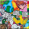
Mural on the north side of Edward Street
Image: © Ian Hawfinch
Taken: 25 Mar 2023
0.05 miles
10
High Street, Brighton
A residential road running between St James's Street and Edward Street that was originally developed in the 1800s though next to nothing is left from that period now with the exception of the Ranelagh Arms on the left which was converted from housing into a pub sometime in the 1930s. Beyond the pub on the left is Ardingly Court and further up on that side are some 1930s council housing built to blend in within the district and are now listed. On the eastern side to the right is high rise St James's Lodge built in the 1960s and beyond the white building is Windsor Lodge erected in 1886 as a chapel but after a variety of uses has been converted to flats.
Image: © Simon Carey
Taken: 11 Oct 2015
0.05 miles


