IMAGES TAKEN NEAR TO
Freshfield Road, BRIGHTON, BN2 0BJ

Introduction

This page details the photographs taken nearby to Freshfield Road, BN2 0BJ by members of the Geograph project.

The Geograph project started in 2005 with the aim of publishing, organising and preserving representative images for every square kilometre of Great Britain, Ireland and the Isle of Man.

There are currently over 7.5m images from over14,400 individuals and you can help contribute to the project by visiting https://www.geograph.org.uk

Image Map


Images are licensed for reuse under creativecommons.org/licenses/by-sa/2.0
Notes
  • Clicking on the map will re-center to the selected point.
  • The higher the marker number, the further away the image location is from the centre of the postcode.

Image Listing (255 Images Found)

Images are licensed for reuse under creativecommons.org/licenses/by-sa/2.0
  • ...
Image
Details
Distance
1
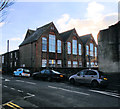
Freshfield Place, BN2
Image: © Mike Quinn Taken: 20 Apr 2012
0.02 miles
2
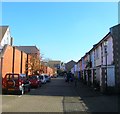
South Avenue, BN2
Image: © Mike Quinn Taken: 20 Apr 2012
0.05 miles
3
Stevenson Road, Freshfield Industrial Estate
The estate was constructed in 1974 on the site of the former Kemp Town station and goods sidings that had been hollowed out of the downland back in 1869 and had closed first to the public in 1932 and to goods in 1971. The houses above are in Evelyn Terrace
Image: © Simon Carey Taken: 11 Jan 2009
0.05 miles
4
Brewers, Stevenson Road, Freshfield Industrial Estate
The industrial estate was opened in 1974 on the site of the former Kemp Town station and goods yard which occupied this spot between 1869-1971. Stevenson Road goes both to the left and right of the showroom forming a circle on what was once sidings.
Image: © Simon Carey Taken: 11 Jan 2009
0.06 miles
5
Stevenson Road, Brighton
Containing Freshfield industrial Estate that was built in the mid 1970s on the site of the former sidings of Kemp Town station. The line was opened in 1869 and contained two halts, one at Lewes Road that was opened in 1873 and another at Hartington Road that followed in 1906. However, passenger traffic was never great and both closed in 1911 the remaining passenger services ceasing in 1933 after which the branch was used for freight only. That too dwindled by the 1960s down to just one coal train a day. With a viaduct, a road bridge and a tunnel to maintain the cost outweighed the benefit and the line closed for good in 1971. See http://regencysociety-jamesgray.com/volume22/source/jg_22_133.html for a view taken in 1969 from the cliff top to the north.
Image: © Simon Carey Taken: 4 Oct 2015
0.06 miles
6
Southdown Mews, Brighton
A cul de sac off Freshfield Road that was built on the site of a former Southdown bus depot that existed here from 1915 until its closure in 1991.
Image: © Simon Carey Taken: 4 Oct 2015
0.06 miles
7
Freshfield Place, Brighton
A residential road that links Freshfield Road to Park Street the road was developed in the late 1890s though much of the southern side has been rebuilt. The houses on the left were built on the site of a former bus depot and are currently part of Image
Image: © Simon Carey Taken: 4 Oct 2015
0.06 miles
8
Queens Park Primary School
website: http://www.queenspark.brighton-hove.sch.uk/
Image: © Paul Gillett Taken: 25 Dec 2018
0.07 miles
9
The Graperies, Brighton
A cul de sac off Park Street built on the site of the former Southdown Coach Depot which operated from here from 1915 until its closure in the 1990s. The name derives from a market garden to the north known as The Graperies and now part of Image
Image: © Simon Carey Taken: 1 Nov 2015
0.07 miles
10
Birds near Queens Park Pond
Ducks, geese and herring gulls are a feature of the park
Image: © Paul Gillett Taken: 13 Nov 2011
0.07 miles
  • ...