IMAGES TAKEN NEAR TO
Granville Road, EASTBOURNE, BN20 7HD
Introduction
This page details the photographs taken nearby to Granville Road, BN20 7HD by members of the Geograph project.
The Geograph project started in 2005 with the aim of publishing, organising and preserving representative images for every square kilometre of Great Britain, Ireland and the Isle of Man.

There are currently over 7.5m images from over14,400 individuals and you can help contribute to the project by visiting https://www.geograph.org.uk
Image Map
Images are licensed for reuse under creativecommons.org/licenses/by-sa/2.0
Notes
- Clicking on the map will re-center to the selected point.
- The higher the marker number, the further away the image location is from the centre of the postcode.
Image Listing (114 Images Found)
Images are licensed for reuse under creativecommons.org/licenses/by-sa/2.0
Image
Details
Distance
3
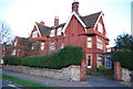
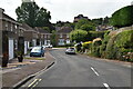
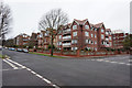
Large Edwardian building, corner of Granville Rd and Carlisle Rd
Image: © N Chadwick
Taken: 12 Apr 2010
0.03 miles
5
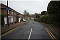
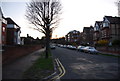
Beristede Close off Carlisle Road, Eastbourne
Image: © Ian S
Taken: 24 Jan 2016
0.03 miles
6
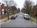
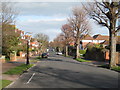
Carlisle Road, Eastbourne
Looking down towards the seafront.
Image: © David Purchase
Taken: 20 Oct 2014
0.04 miles
9
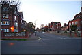
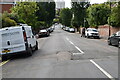
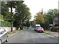
Carlisle Rd and Granville Rd junction
Streets of Edwardian housing.
Image: © N Chadwick
Taken: 12 Apr 2010
0.04 miles