
IMAGES TAKEN NEAR TO
Wayside, EASTBOURNE, BN20 0HS
Introduction
This page details the photographs taken nearby to Wayside, BN20 0HS by members of the Geograph project.
The Geograph project started in 2005 with the aim of publishing, organising and preserving representative images for every square kilometre of Great Britain, Ireland and the Isle of Man.

There are currently over 7.5m images from over14,400 individuals and you can help contribute to the project by visiting https://www.geograph.org.uk
Image Map
Images are licensed for reuse under creativecommons.org/licenses/by-sa/2.0
Notes
- Clicking on the map will re-center to the selected point.
- The higher the marker number, the further away the image location is from the centre of the postcode.
Image Listing (320 Images Found)
Images are licensed for reuse under creativecommons.org/licenses/by-sa/2.0
Image
Details
Distance
1
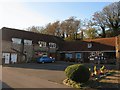
Barn Stores and Post Office, East Dean
The former barns and stables of Gore Farm have been converted into a small shopping area, through the walkway next to Barn Stores are a vet and hairdressers. The Post Office moved here from Lower Street in 2008 which means the main village shops are concentrated in an area north of the A259 where most of the population now reside. South of the main road in the old part of the village those shops that still exist are now geared towards the tourist trade.
Image: © Simon Carey
Taken: 23 Nov 2013
0.01 miles
2
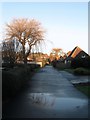
Wayside, East Dean
Small cul de sac off Wenthill Close developed after the Second World War.
Image: © Simon Carey
Taken: 26 Dec 2013
0.02 miles
4
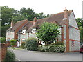
Gore Farm Close
Cluster of ten cottages built in the vernacular tradition, close to the shops and a remarkably frequent bus service.
Image: © David M Clark
Taken: 18 Jul 2023
0.03 miles
5
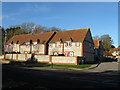
Gore Farm Close, East Dean
A recent development, circa 2008, on the site of an old farm. The former barns have now been converted into a small shopping area, see Image
Image: © Simon Carey
Taken: 23 Nov 2013
0.03 miles
6
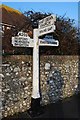
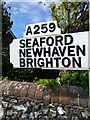
Old Direction Sign - Signpost by the A259, Eastbourne Road, East Dean
Black iron cap finial - 3 arms; East Sussex wood with number by the A259, in parish of East Dean and Friston (Wealden District), Eastbourne Road junction with Gilbert's Drive, on pavement opposite junction.
Surveyed
Milestone Society National ID: SX_TV5597D.
Image: © Milestone Society
Taken: Unknown
0.03 miles
7
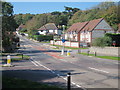
Eastbourne Road
A259 through East Dean. Gilberts Drive to the left.
Image: © Oast House Archive
Taken: 3 Oct 2011
0.04 miles
9
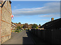
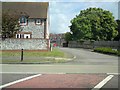
Downlands Way, East Dean
The only access road for Image The houses date from the 1970s.
Image: © Simon Carey
Taken: 23 Nov 2013
0.04 miles
10
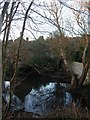
Old Farm Pond, East Dean
Originally belonging to Gore Farm the pond was once much larger and like a number of downland ponds split into two by the flint wall visible in the picture. The southern side would have been for the exclusive use of the farm, whilst the northern portion lying adjacent to the modern A259 would have been used by drovers and their livestock using the road. That section was filled in during the 1920s as droving was replaced by the combustion engine and is now the site of East Dean's main bus stop.
Image: © Simon Carey
Taken: 26 Dec 2013
0.05 miles