
IMAGES TAKEN NEAR TO
Braeside Avenue, BRIGHTON, BN1 8SQ
Introduction
This page details the photographs taken nearby to Braeside Avenue, BN1 8SQ by members of the Geograph project.
The Geograph project started in 2005 with the aim of publishing, organising and preserving representative images for every square kilometre of Great Britain, Ireland and the Isle of Man.

There are currently over 7.5m images from over14,400 individuals and you can help contribute to the project by visiting https://www.geograph.org.uk
Image Map
Images are licensed for reuse under creativecommons.org/licenses/by-sa/2.0
Notes
- Clicking on the map will re-center to the selected point.
- The higher the marker number, the further away the image location is from the centre of the postcode.
Image Listing (17 Images Found)
Images are licensed for reuse under creativecommons.org/licenses/by-sa/2.0
Image
Details
Distance
1
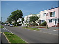
Patcham: Braeside Avenue (1)
These houses in Braeside Avenue were built in the 1930s and, the A27 dual carriageway aside, still represent the northernmost incursion of the built-up area of Brighton into the South Downs in this area.
Image: © Nigel Cox
Taken: 8 Jun 2008
0.07 miles
2
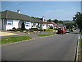
Patcham: Braeside Avenue (2)
Although a lot of them have been altered through the years most of the bungalows on this estate were originally built with the attractive half-circular entrance porches, as seen in the one on the left, with brick courses radiating outwards in a sunshine motif.
Image: © Nigel Cox
Taken: 8 Jun 2008
0.07 miles
3
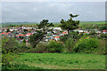
View north-west from Ladies Mile
Looking towards an extremity of Patcham.
Image: © Robin Webster
Taken: 30 Apr 2010
0.07 miles
4
Path in woods - Patcham
Near to the A27 at the north of Patcham
Image: © Paul Gillett
Taken: 22 May 2009
0.09 miles
5
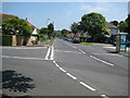
Patcham: Mackie Avenue
Viewed looking from its junction with Kenmure Avenue.
Image: © Nigel Cox
Taken: 8 Jun 2008
0.13 miles
6
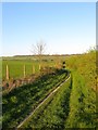
Bridleway to Ditchling Road
Running parallel to the A27 from Braypool Lane to the entrance to the Upper Lodges Car Park on Ditchling Road. Upper Lodges Wood can be seen in the distance.
Image: © Simon Carey
Taken: 16 Apr 2014
0.13 miles
7
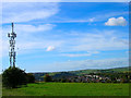
Communications mast, Patcham
Looking west from the high ground that separates the industrial estate from the Ladies Mile estate of Patcham on the outskirts of the Brighton & Hove conurbation. The Ladies Mile estate is built into a natural dip in the Downs.
Image: © Simon Carey
Taken: 9 Oct 2005
0.14 miles
8
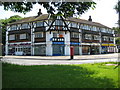
Patcham: Mackie Avenue shops
Since time immemorial this parade of shops at Mackie Avenue has been the Patcham terminus for Brighton bus routes 5 and 5A from Hangleton.
Image: © Nigel Cox
Taken: 8 Jun 2008
0.17 miles
10

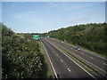
New Croft (2)
The name of the field according to Patcham's 1842 tithe map viewed from the bridleway that runs parallel to the A27. Upper Lodges Wood can be seen in the distance.
Image: © Simon Carey
Taken: 16 Apr 2014
0.20 miles