
IMAGES TAKEN NEAR TO
Brompton Close, BRIGHTON, BN1 8QD
Introduction
This page details the photographs taken nearby to Brompton Close, BN1 8QD by members of the Geograph project.
The Geograph project started in 2005 with the aim of publishing, organising and preserving representative images for every square kilometre of Great Britain, Ireland and the Isle of Man.

There are currently over 7.5m images from over14,400 individuals and you can help contribute to the project by visiting https://www.geograph.org.uk
Image Map
Images are licensed for reuse under creativecommons.org/licenses/by-sa/2.0
Notes
- Clicking on the map will re-center to the selected point.
- The higher the marker number, the further away the image location is from the centre of the postcode.
Image Listing (51 Images Found)
Images are licensed for reuse under creativecommons.org/licenses/by-sa/2.0
Image
Details
Distance
1
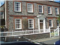
House in Old London Road, Patcham
The Old London Road was part of the main London Road until the Patcham by-pass opened in 1926. It retains many listed buildings dating mainly to the 18th century.
http://www.mybrightonandhove.org.uk/category_id__714_path__0p114p450p.aspx
Image: © Paul Gillett
Taken: 22 May 2009
0.05 miles
2
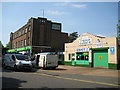
Patcham: Old London Road (2)
The 1899 Ordnance Survey map shows a smithy on the site of Patcham Garage, while the mosaic with the black writing on a white background on the larger brick building reads 'Brighton Equitable Co-operative Society Limited'.
Image: © Nigel Cox
Taken: 8 Jun 2008
0.07 miles
3
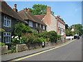
Patcham: Old London Road (1)
Houses faced with both knapped and unknapped flints can be found in the centre of the old part of Patcham village, here lining the Old London Road. The narrowness of the road here, coupled with the amount of tourist traffic to Brighton, made a bypass essential from the very early days of motoring, and the current A23 London Road that bypasses this part of Patcham to the west was built in 1926, being shown on the 1930 edition of the Ordnance Survey map.
Image: © Nigel Cox
Taken: 8 Jun 2008
0.07 miles
4
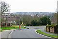
Brangwyn Crescent meets the A23
Most crescents return to the road they left, but this one does not. It changes name to Windmill Drive directly above the Patcham railway tunnel. Windmill Drive does not return either.
Image: © Robin Webster
Taken: 7 Apr 2010
0.11 miles
6
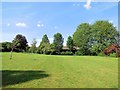
Peace Gardens, Patcham
located between London Road (A23) and the Old London Road
Image: © Paul Gillett
Taken: 29 Jun 2013
0.13 miles
8
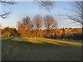
Peace Gardens, Patcham
Between the Old London Road and the Patcham By Pass
Patcham Peace Gardens cover 3.12 acres of land which were purchased from the Abergavenny estate in June 1928, chiefly through the efforts of Herbert Carden; it had been planned to build a petrol station on the site. The northern half of the gardens is a simple grassed area, but the southern half was laid out as an attractive sunken rose garden and includes a Tuscan pergola and a small Doric temple, both purchased from the 1924 Wembley Exhibition; the temple is decorated with fruit motifs and figureheads. http://www.mybrightonandhove.org.uk/page_id__8438_path__0p114p450p815p.aspx
Image: © Paul Gillett
Taken: 9 Jan 2011
0.14 miles
9
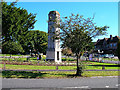
Clock Tower, Ladies Mile, Patcham
Built in the 1930s to advertise the newly built Ladies Mile estate. Looking north east Mackie Avenue leads off to the right whilst the road in the foreground Vale Avenue twists north then west to the northern end of the old village of Patcham and the A23/A27 interchange.
Image: © Simon Carey
Taken: 18 Sep 2005
0.14 miles
10

Patcham Clock Tower
Another view of the clock tower on the Ladies Mile estate first submitted by Simon Image, it's good to report that the clock was telling the correct time. The Ladies Mile estate was developed by George Ferguson in the 1930s.
Image: © Nigel Cox
Taken: 8 Jun 2008
0.14 miles