Patcham: Old London Road (2)
Introduction
The photograph on this page of Patcham: Old London Road (2) by Nigel Cox as part of the Geograph project.
The Geograph project started in 2005 with the aim of publishing, organising and preserving representative images for every square kilometre of Great Britain, Ireland and the Isle of Man.

There are currently over 7.5m images from over 14,400 individuals and you can help contribute to the project by visiting https://www.geograph.org.uk
Patcham: Old London Road (2)
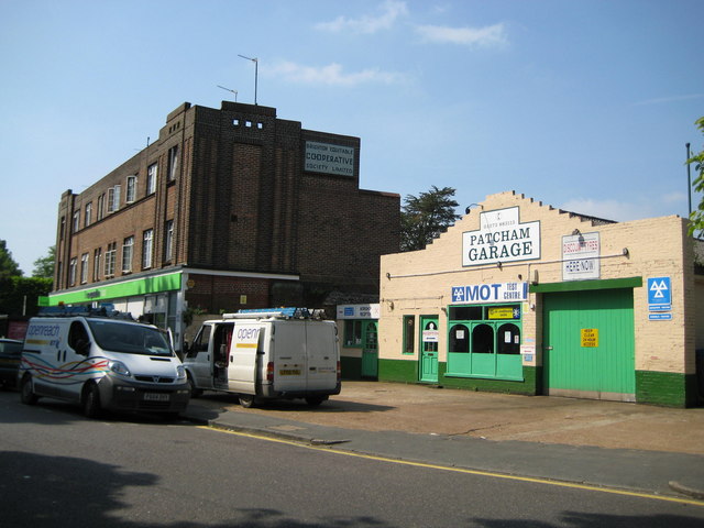
Image: © Nigel Cox Taken: 8 Jun 2008
The 1899 Ordnance Survey map shows a smithy on the site of Patcham Garage, while the mosaic with the black writing on a white background on the larger brick building reads 'Brighton Equitable Co-operative Society Limited'.
Images are licensed for reuse under creativecommons.org/licenses/by-sa/2.0
Image Location
Latitude
50.863157
Longitude
-0.151291