IMAGES TAKEN NEAR TO
Blakehurst, ARUNDEL, BN18 9QG

Introduction

This page details the photographs taken nearby to Blakehurst, BN18 9QG by members of the Geograph project.

The Geograph project started in 2005 with the aim of publishing, organising and preserving representative images for every square kilometre of Great Britain, Ireland and the Isle of Man.

There are currently over 7.5m images from over14,400 individuals and you can help contribute to the project by visiting https://www.geograph.org.uk

Image Map


Images are licensed for reuse under creativecommons.org/licenses/by-sa/2.0
Notes
  • Clicking on the map will re-center to the selected point.
  • The higher the marker number, the further away the image location is from the centre of the postcode.

Image Listing (16 Images Found)

Images are licensed for reuse under creativecommons.org/licenses/by-sa/2.0
Image
Details
Distance
1
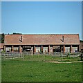
Barn with red doors, Warningcamp
Image: © nick macneill Taken: 15 Feb 2013
0.00 miles
2
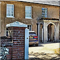
House at Blakehurst Farm
Image: © Ian Hawfinch Taken: 31 May 2021
0.00 miles
3
Dukes Barns
This barn conversion comprises five dwellings according to the website. The name refers to the Duke of Norfolk, whose seat is the nearby Arundel Castle. Presumably the barns originally belonged to Blakehurst Farm.
Image: © Ian Hawfinch Taken: 31 May 2021
0.04 miles
4
Barn, Blakehurst Farm, Warningcamp
Image: © nick macneill Taken: 15 Feb 2013
0.05 miles
5
The Great Field
The name of the field according to Warningcamp's 1840 tithe map that has been extended to include Image to the north and Image to the west. Viewed from the footpath that links Blakehurst Farm to Warningcamp.
Image: © Simon Carey Taken: 20 Aug 2013
0.09 miles
6
Fields near Blakehurst Farm
Image: © Chris Thomas-Atkin Taken: 28 Jan 2019
0.10 miles
7
Dell Hole Ten Acres
The name of the field according to Warningcamp's 1840 tithe map viewed from Blakehurst Lane. As the name suggests there was once a pit in this field which abutted onto the lane but seems to have been filled in and levelled out by the 1970s. The wood in the far distance on the left is Gibbet Piece.
Image: © Simon Carey Taken: 20 Aug 2013
0.13 miles
8
Reed Farm Eight
The name of the field according to Warningcamp's 1840 tithe map with the eight referencing the size of the field in acres. Reeds Farm is now known as Old Blakehurst and lies to the east. Reeds Copse is the wood at the end of the field.
Image: © Simon Carey Taken: 20 Aug 2013
0.14 miles
9
Pond, Coots Dale
The pond first makes an appearance on the 1937-40 OS map though the older name of the wood is Cats Dell, with the latter suggesting a pit or excavation in the vicinity. See also Image
Image: © Simon Carey Taken: 20 Aug 2013
0.15 miles
10
Blakehurst Farm
Looking north near middle of square.
Image: © Chris Shaw Taken: Unknown
0.17 miles