IMAGES TAKEN NEAR TO
Arundel Road, ARUNDEL, BN18 9PW
Introduction
This page details the photographs taken nearby to Arundel Road, BN18 9PW by members of the Geograph project.
The Geograph project started in 2005 with the aim of publishing, organising and preserving representative images for every square kilometre of Great Britain, Ireland and the Isle of Man.

There are currently over 7.5m images from over14,400 individuals and you can help contribute to the project by visiting https://www.geograph.org.uk
Image Map
Images are licensed for reuse under creativecommons.org/licenses/by-sa/2.0
Notes
- Clicking on the map will re-center to the selected point.
- The higher the marker number, the further away the image location is from the centre of the postcode.
Image Listing (29 Images Found)
Images are licensed for reuse under creativecommons.org/licenses/by-sa/2.0
Image
Details
Distance
1
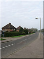
Council Cottages, Poling Corner
Originally built on the A27 during the 1930s but now have their own slip road next to the busy dual carriageway. As the name indicates originally a small council estate built for local agricultural workers.
Image: © Simon Carey
Taken: 13 Apr 2009
0.02 miles
5
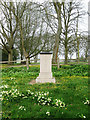
Millennium Monument, Poling Corner
Unveiled in 2005 after funds were raised solely by the villagers. The side facing has Poling 2000 carved into it whilst others out of view have an oak tree, St Nicholas' church and poem entitled Paling not Poling celebrating the original Saxon name of the settlement which has changed little over 1500 years. The top remains empty but has been left flat with the idea that something suitable might be added in the future.
Image: © Simon Carey
Taken: 13 Apr 2009
0.09 miles
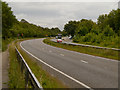
7
Better late than never
Also see http://www.geograph.org.uk/photo/1998987
Image: © Basher Eyre
Taken: 1 Mar 2011
0.09 miles
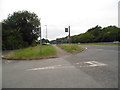
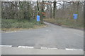
8
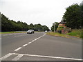
Blakehurst Lane approaching its junction with the A27
Image: © Dave Spicer
Taken: 25 Jun 2011
0.09 miles
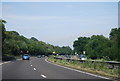
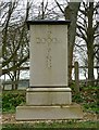
10
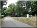
South to Poling
From the A27 this road leads to Poling only, a haven of peace, the stone on the right is the Millennium Stone which due to a funding and stonemason problem was not in place until 2005.
Image: © Martin Dawes
Taken: 26 Jul 2010
0.10 miles