IMAGES TAKEN NEAR TO
Ford Lane Business Park, ARUNDEL, BN18 0UZ
Introduction
This page details the photographs taken nearby to Ford Lane Business Park, BN18 0UZ by members of the Geograph project.
The Geograph project started in 2005 with the aim of publishing, organising and preserving representative images for every square kilometre of Great Britain, Ireland and the Isle of Man.

There are currently over 7.5m images from over14,400 individuals and you can help contribute to the project by visiting https://www.geograph.org.uk
Image Map (Loading...)


Getting Data...Please wait
Leaflet Map data © OpenStreetMap
Images are licensed for reuse under creativecommons.org/licenses/by-sa/2.0
Notes
- Clicking on the map will re-center to the selected point.
- The higher the marker number, the further away the image location is from the centre of the postcode.
Image Listing (33 Images Found)
Images are licensed for reuse under creativecommons.org/licenses/by-sa/2.0
Image
Details
Distance
1
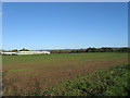
The Green Field
The name of the field according to the 1839 tithe map. Ford Lane Business Park is to the left.
Image: © Simon Carey
Taken: 24 Oct 2010
0.06 miles
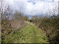
4
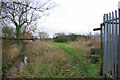
Footpath to Goose Green
The corner of an industrial estate is on the right. The path starts along one of its roads.
Image: © Robin Webster
Taken: 12 Feb 2007
0.07 miles
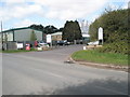
5
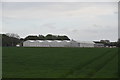
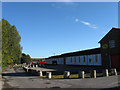
Ford Lane Business Park
Viewed from Ford Lane. The business park evolved from the old photographic school belonging to Ford Airfield that was closed in 1958 with the park itself opening in 1963.
Image: © Simon Carey
Taken: 24 Oct 2010
0.08 miles
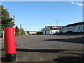
6
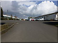
Junction of Ford Lane and The Business Park
Image: © Basher Eyre
Taken: 8 Apr 2009
0.09 miles
8
View north along footpath 365
The path connects to Hoe Lane south of Binsted.
Image: © Dave Spicer
Taken: 19 Mar 2013
0.10 miles
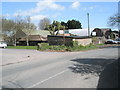
9
Ford Lane Business Park
Viewed from Ford Lane. Part of the drive is the start of the footpath to Binsted. The business park evolved from the site of the old photographic school belonging to Ford Airfield which closed in 1958. Many of the temporary buildings still remain in use today in the park along with concrete anti-tank cylinders in view.
Image: © Simon Carey
Taken: 24 Oct 2010
0.11 miles
