IMAGES TAKEN NEAR TO
Sunny Box Lane, ARUNDEL, BN18 0LX
Introduction
This page details the photographs taken nearby to Sunny Box Lane, BN18 0LX by members of the Geograph project.
The Geograph project started in 2005 with the aim of publishing, organising and preserving representative images for every square kilometre of Great Britain, Ireland and the Isle of Man.

There are currently over 7.5m images from over14,400 individuals and you can help contribute to the project by visiting https://www.geograph.org.uk
Image Map (Loading...)


Getting Data...Please wait
Leaflet Map data © OpenStreetMap
Images are licensed for reuse under creativecommons.org/licenses/by-sa/2.0
Notes
- Clicking on the map will re-center to the selected point.
- The higher the marker number, the further away the image location is from the centre of the postcode.
Image Listing (10 Images Found)
Images are licensed for reuse under creativecommons.org/licenses/by-sa/2.0
Image
Details
Distance
1
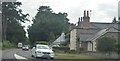
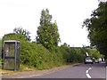
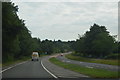
Mill Road
Minor road linking the A29 to the A27. The road is straight with one kink due to the fact that it once ran through two commons that were inclosed at different periods, Walberton Common to the south went in 1769 whilst Slindon Common in 1870. The houses in view lie between two roads, Bridle Road to the north and Sunnybox Lane to the south that were built between the wars.
Image: © Simon Carey
Taken: 30 Oct 2010
0.14 miles
2
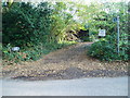
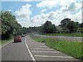
Start of bridleway 395
Route from Shellbridge Road (B2132) to Rewell Wood.
Image: © Peter Holmes
Taken: 6 Nov 2011
0.14 miles
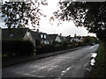
3
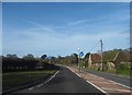
Shellbridge Road
Heading towards Slindon close to Bridle Cottage.
Image: © Chris Thomas-Atkin
Taken: 14 Jan 2019
0.14 miles
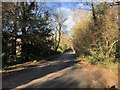
4
Mill Road, Slindon
Cars parked for car-sharing by drivers on the A29
Image: © David Smith
Taken: 5 Jul 2015
0.17 miles
7
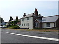
Houses at Slindon Common
This row of houses is next to the junction crossroads of Reynolds Lane, Mill Road and Fairmile Bottom
Image: © Nigel Mykura
Taken: 22 Jul 2013
0.21 miles
9
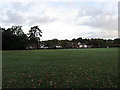
Slindon Cricket Ground
Looking towards the houses on the A29. Slindon's cricket club is over 250 years old and briefly became one of the best sides in England in the 1740s when under the patronage of the Duke of Richmond the team were beating county sides. Like all small clubs the success was not sustainable once the patron died and the cricket club sunk back into obscurity. The current cricket ground stands on land that was once part of Slindon Common until its inclosure in the 1870s.
Image: © Simon Carey
Taken: 30 Oct 2010
0.22 miles