IMAGES TAKEN NEAR TO
Station Road, ARUNDEL, BN18 0BL
Introduction
This page details the photographs taken nearby to Station Road, BN18 0BL by members of the Geograph project.
The Geograph project started in 2005 with the aim of publishing, organising and preserving representative images for every square kilometre of Great Britain, Ireland and the Isle of Man.

There are currently over 7.5m images from over14,400 individuals and you can help contribute to the project by visiting https://www.geograph.org.uk
Image Map
Images are licensed for reuse under creativecommons.org/licenses/by-sa/2.0
Notes
- Clicking on the map will re-center to the selected point.
- The higher the marker number, the further away the image location is from the centre of the postcode.
Image Listing (181 Images Found)
Images are licensed for reuse under creativecommons.org/licenses/by-sa/2.0
Image
Details
Distance
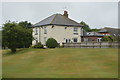
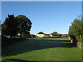
3
Lock Cottage, Ford
Formerly two company cottages of the Portsmouth and Arundel Canal, by the second and top lock up from the Arun. For many years these, and indeed the general area, were dominated by the engine house and chimney for the pump needed to supply the long and leaky summit level of the canal with water from the Arun. This building was just to the right of the cottages, but had gone by the later 19th century.
Image: © Robin Webster
Taken: 24 May 2010
0.01 miles
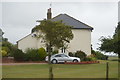
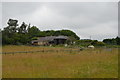
4
Lock Cottage
Built in 1818 originally as a pair but now converted into one house. The strip of ground between myself and the cottage should by an archeologists delight containing the line of the old Arundel-Chichester canal as well as the site of the original deserted village of Ford. The canal ran diagonally through this small field with the cottage, which housed the workers who manned one of two locks in the vicinity, lying to the north of the waterway. The wall on the left belongs to Ford church.
Image: © Simon Carey
Taken: 24 Oct 2010
0.02 miles
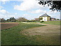
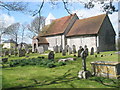
7
Locks Cottage, Ford
Originally a pair of cottages built in 1820 for the lock keeper on the Portsmouth-Arundel canal. The bump in the road and the cottage's garden indicates the route taken by the canal. Prior to the construction of the cottages no buildings stood near the church (seen at the end of the lane) the village having lost most its population and buildings by the 17th century and by 1801 only 8 houses existed in the parish as a whole. However, the coming of the canal, then railway, then airfield has increased the population. A row of houses built in 1938 along Ford Road near the current prison was to be the start of another large housing estate but war then tougher planning laws halted that growth though plans to convert the airfield into a 5000 house eco-village are currently being investigated.
Image: © Simon Carey
Taken: 21 Mar 2008
0.03 miles
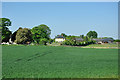
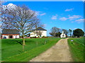
8
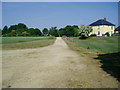
Track from Ford Church to Station Road
Public footpath 364/1. Realignment of right of way as shown on OS explorer map. The Landranger map indicates a route across field to the south of this track.
Image: © Peter Holmes
Taken: 5 Jun 2010
0.03 miles
9
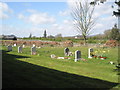
Looking from St Andrew's Churchyard over to Church Farm
Image: © Basher Eyre
Taken: 8 Apr 2009
0.03 miles