
IMAGES TAKEN NEAR TO
Roedale Road, BRIGHTON, BN1 7GB
Introduction
This page details the photographs taken nearby to Roedale Road, BN1 7GB by members of the Geograph project.
The Geograph project started in 2005 with the aim of publishing, organising and preserving representative images for every square kilometre of Great Britain, Ireland and the Isle of Man.

There are currently over 7.5m images from over14,400 individuals and you can help contribute to the project by visiting https://www.geograph.org.uk
Image Map
Images are licensed for reuse under creativecommons.org/licenses/by-sa/2.0
Notes
- Clicking on the map will re-center to the selected point.
- The higher the marker number, the further away the image location is from the centre of the postcode.
Image Listing (99 Images Found)
Images are licensed for reuse under creativecommons.org/licenses/by-sa/2.0
Image
Details
Distance
3
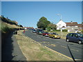
Davey Drive
viewed from the Upper Hollingdean Road
Image: © Paul Gillett
Taken: 27 Jun 2009
0.06 miles
4

Hollingdean Terrace, Hollingdean, Brighton
A residential road that runs from Roedale Road in the south to Hollingbury Rose in the north that was developed in the early 1900s. This is the southern part, see Image for the northern portion some of which can be seen in the distance.
Image: © Simon Carey
Taken: 4 Oct 2015
0.06 miles
5
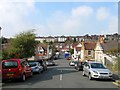
Hollingdean Street, Hollingdean, Brighton
A minor street that runs from Dudley Road in the east, crosses Roedale Road and finishes on Hollingdean Terrace in the west. Beyond the later further up the slope are the rear views of houses facing Hollingbury Road, one of which I used to live in. The street contains just one building, see Image
Image: © Simon Carey
Taken: 4 Oct 2015
0.07 miles
6

Chapel of the Holy Family, Hollingdean Street, Hollingdean, Brighton
Built in 2002 and home to the Society of St Pius X , an unofficial priestly catholic society who have been in schism with the Holy See since 1988.
Image: © Simon Carey
Taken: 4 Oct 2015
0.08 miles

8
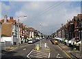
Hollingbury Road, Hollingdean, Brighton
The road runs from Upper Hollingdean Road to Fiveways with the western side developed in the late 1890s and the eastern side a decade later. Despite being a residential road it has always been a bit of a rat run for those wishing to get to or come from Lewes Road.
Image: © Simon Carey
Taken: 4 Oct 2015
0.08 miles
9

Sign for the Hollingbury public house, Brighton
Image: © JThomas
Taken: 4 Apr 2025
0.08 miles
