IMAGES TAKEN NEAR TO
Surrey Street, LITTLEHAMPTON, BN17 5DZ
Introduction
This page details the photographs taken nearby to Surrey Street, BN17 5DZ by members of the Geograph project.
The Geograph project started in 2005 with the aim of publishing, organising and preserving representative images for every square kilometre of Great Britain, Ireland and the Isle of Man.

There are currently over 7.5m images from over14,400 individuals and you can help contribute to the project by visiting https://www.geograph.org.uk
Image Map
Images are licensed for reuse under creativecommons.org/licenses/by-sa/2.0
Notes
- Clicking on the map will re-center to the selected point.
- The higher the marker number, the further away the image location is from the centre of the postcode.
Image Listing (572 Images Found)
Images are licensed for reuse under creativecommons.org/licenses/by-sa/2.0
Image
Details
Distance
1
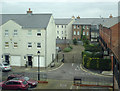
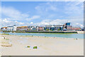
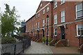
Entrance to Netley Court in Littlehampton, West Sussex
Recently built housing (flats and terraced houses) near old Quay Wharf by the River Arun.
Image: © Roger D Kidd
Taken: 31 Dec 2014
0.00 miles
2
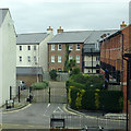
Entrance to Netley Court in Littlehampton, West Sussex
Recently built housing (flats and terraced houses) near old Quay Wharf by the River Arun.
Image: © Roger D Kidd
Taken: 31 Dec 2014
0.01 miles
4
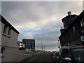
My first ever seaside visit re-traced (12)
Looking from the river path towards Surrey Street
Image: © Basher Eyre
Taken: 11 Jul 2020
0.01 miles
5
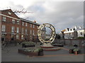
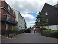
Sculpture between River Road and Surrey Street
Image: © Basher Eyre
Taken: 7 Dec 2013
0.01 miles
7
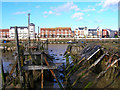
Old Quay Wharf
On the eastern bank of the Arun and the oldest known site of a harbour in Littlehampton, being the town's quay from the 17th century. Now largely redeveloped and viewed from The Harbour on the western bank where the rotting hulks of abandoned vessels juxtapose nicely the old and the new.
Image: © Simon Carey
Taken: 21 Mar 2008
0.02 miles
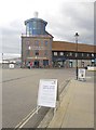
8
Across the River Arun
Looking across the River Arun at low tide, with the RNLI lifeboat station on Fisherman's Hard in the centre of the photo, with the residential developments of Mariners Quay on the left and Wight Court on the right. On the far right is the RNLI lifeboat station on Fisherman's Hard.
Image: © Ian Capper
Taken: 4 May 2024
0.02 miles
10
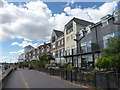
My first ever seaside visit re-traced (10)
Flats on the river
Image: © Basher Eyre
Taken: 11 Jul 2020
0.02 miles