IMAGES TAKEN NEAR TO
Surrenden Road, BRIGHTON, BN1 6NN
Introduction
This page details the photographs taken nearby to Surrenden Road, BN1 6NN by members of the Geograph project.
The Geograph project started in 2005 with the aim of publishing, organising and preserving representative images for every square kilometre of Great Britain, Ireland and the Isle of Man.

There are currently over 7.5m images from over14,400 individuals and you can help contribute to the project by visiting https://www.geograph.org.uk
Image Map
Images are licensed for reuse under creativecommons.org/licenses/by-sa/2.0
Notes
- Clicking on the map will re-center to the selected point.
- The higher the marker number, the further away the image location is from the centre of the postcode.
Image Listing (15 Images Found)
Images are licensed for reuse under creativecommons.org/licenses/by-sa/2.0
Image
Details
Distance
1
Post box on Friar Road
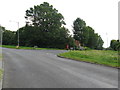
Surrenden Road curves to the left to meet Ditchling Road.
Image: © Dave Spicer
Taken: 12 Aug 2012
0.15 miles
2
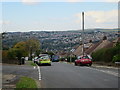
Friar Road, Hollingbury
Residential road linking Surrenden Road to Ditchling Road.
Image: © Simon Carey
Taken: 20 Jan 2013
0.15 miles
4
Covered Reservoir, Hollingbury
Built in the 1920s to serve the rapidly expanding boundaries of the town.
Image: © Simon Carey
Taken: 20 Jan 2013
0.18 miles
5
Reservoir, Hollingbury
Covered reservoirs, the bank on the left has uncommon plants.
Image: © Robin Webster
Taken: 30 Apr 2010
0.18 miles
6
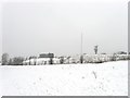
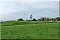
Recreation Ground and Reservoirs, Roedale, Brighton
Looking north from near the play area towards the reservoir tanks on the skyline with radio masts.
Image: © Bob Embleton
Taken: 11 Sep 2005
0.19 miles
8
Upper Roedale Cottages
Confusingly also known as Roedale the middle portion of a few cottages with Upper Roedale to the north near the current Hollingbury Park golf course's clubhouse, and Lower Roedale to the south now consisting of a couple of buildings on Stanmer Drive.
Image: © Simon Carey
Taken: 20 Jan 2013
0.20 miles
9
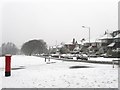
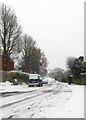
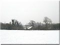
Surrenden Road
This section runs westwards from Ditchling Road before it turns south when meeting Peacock Lane and Braybon Avenue. The junction with Image is in the foreground whilst the postbox gives the monochrome snow scene its only splash of colour.
Image: © Simon Carey
Taken: 20 Jan 2013
0.21 miles
10
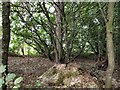
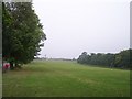
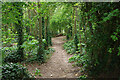
Hollingbury Park Local Nature Reserve
Image: © Paul Gillett
Taken: 19 Sep 2010
0.22 miles