
IMAGES TAKEN NEAR TO
Southdown Avenue, BRIGHTON, BN1 6EG
Introduction
This page details the photographs taken nearby to Southdown Avenue, BN1 6EG by members of the Geograph project.
The Geograph project started in 2005 with the aim of publishing, organising and preserving representative images for every square kilometre of Great Britain, Ireland and the Isle of Man.

There are currently over 7.5m images from over14,400 individuals and you can help contribute to the project by visiting https://www.geograph.org.uk
Image Map
Images are licensed for reuse under creativecommons.org/licenses/by-sa/2.0
Notes
- Clicking on the map will re-center to the selected point.
- The higher the marker number, the further away the image location is from the centre of the postcode.
Image Listing (173 Images Found)
Images are licensed for reuse under creativecommons.org/licenses/by-sa/2.0
Image
Details
Distance
1

Victorian postbox, Southdown Avenue / Florence Road, BN1
Image: © Mike Quinn
Taken: 25 Jun 2014
0.02 miles
2

Victorian postbox, Southdown Avenue / Florence Road, BN1 - royal cipher
See Image
Image: © Mike Quinn
Taken: 25 Jun 2014
0.02 miles
3
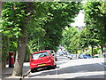
Southdown Avenue, BN1
Shows the location of Image
Image: © Mike Quinn
Taken: 25 Jun 2014
0.02 miles
4

Florence Road / Southdown Avenue, BN1
Shows the location of Image
Image: © Mike Quinn
Taken: 25 Jun 2014
0.04 miles
5
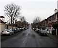
Rugby Road
Connecting Stanford Avenue with Ditchling Road and developed in the 1890s.
Image: © Simon Carey
Taken: 11 Jan 2009
0.05 miles
7

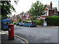
Springfield Road
Residential street linking Ditchling Road to Preston Road, the A23, which was developed like much of the area immediately to the north of the Brighton-Lewes railway in the 1860s.
Image: © Simon Carey
Taken: 12 Mar 2013
0.05 miles
8
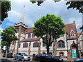
One Church, Florence Road / Southdown Avenue, BN1
Gloucester Place and Florence Road Baptist Churches have joined together to become "One Church Brighton".
Image: © Mike Quinn
Taken: 25 Jun 2014
0.07 miles
9
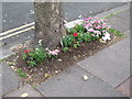
"Streets in Bloom, 2014", Southdown Avenue, BN1
Image: © Mike Quinn
Taken: 25 Jun 2014
0.07 miles
10
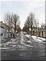
Edburton Avenue
A residential road linking Rugby Road to Preston Drove that was developed from the 1860s onwards.
Image: © Simon Carey
Taken: 12 Mar 2013
0.08 miles