IMAGES TAKEN NEAR TO
Woodlands Avenue, LITTLEHAMPTON, BN16 3HB
Introduction
This page details the photographs taken nearby to Woodlands Avenue, BN16 3HB by members of the Geograph project.
The Geograph project started in 2005 with the aim of publishing, organising and preserving representative images for every square kilometre of Great Britain, Ireland and the Isle of Man.

There are currently over 7.5m images from over14,400 individuals and you can help contribute to the project by visiting https://www.geograph.org.uk
Image Map
Images are licensed for reuse under creativecommons.org/licenses/by-sa/2.0
Notes
- Clicking on the map will re-center to the selected point.
- The higher the marker number, the further away the image location is from the centre of the postcode.
Image Listing (59 Images Found)
Images are licensed for reuse under creativecommons.org/licenses/by-sa/2.0
Image
Details
Distance
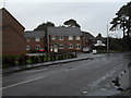
1
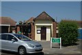
Rustington old fire station
Rustington old fire station, Woodlands Avenue, Rustington, West Sussex, which was only used as a fire station during World War 2. Now used as council offices.
Image: © Kevin Hale
Taken: 28 Jun 2010
0.04 miles
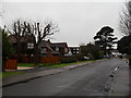
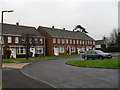
2
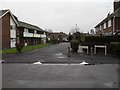
Looking from Woodlands Avenue into Woodlands Close
Image: © Basher Eyre
Taken: 16 Jan 2010
0.05 miles
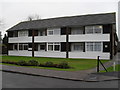
5
Looking from Mill Lane over to The Elms
Image: © Basher Eyre
Taken: 16 Jan 2010
0.07 miles
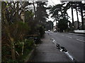
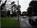
6
Woodlands Avenue on a dreary January morning
Image: © Basher Eyre
Taken: 16 Jan 2010
0.07 miles
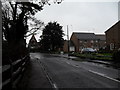
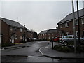
10
Approaching the junction of Mill Lane and Stansfield Court
Image: © Basher Eyre
Taken: 16 Jan 2010
0.08 miles