IMAGES TAKEN NEAR TO
Middle Way, LITTLEHAMPTON, BN16 1RY

Introduction

This page details the photographs taken nearby to Middle Way, BN16 1RY by members of the Geograph project.

The Geograph project started in 2005 with the aim of publishing, organising and preserving representative images for every square kilometre of Great Britain, Ireland and the Isle of Man.

There are currently over 7.5m images from over14,400 individuals and you can help contribute to the project by visiting https://www.geograph.org.uk

Image Map


Images are licensed for reuse under creativecommons.org/licenses/by-sa/2.0
Notes
  • Clicking on the map will re-center to the selected point.
  • The higher the marker number, the further away the image location is from the centre of the postcode.

Image Listing (84 Images Found)

Images are licensed for reuse under creativecommons.org/licenses/by-sa/2.0
  • ...
Image
Details
Distance
1
Hinterland margins of Kingston Gorse
Image: © Fernweh Taken: 1 Nov 2014
0.04 miles
2
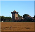
The Tower, Seaview Avenue, Kingston Gorse
A former water tower converted into a residential dwelling. Built between the wars it appears to have been become a dwelling some time after 1945.
Image: © Simon Carey Taken: 13 Aug 2017
0.06 miles
3
Access road - Kingston Gorse
Image: © Fernweh Taken: 1 Nov 2014
0.06 miles
4
Sea Lane House
House on the corner of Sea Lane and Coastal Road. Completed in 1937, it was designed by Marcel Bauer and F R S Yorke. Grade II listed - see www.historicengland.org.uk/listing/the-list/list-entry/1353897.
Image: © Ian Capper Taken: 26 Oct 2021
0.09 miles
5
Beach House, Gorse Avenue, Kingston Gorse
The name of the large flat roofed building on the left previously known as Dolphins.
Image: © Simon Carey Taken: 13 Aug 2017
0.10 miles
6
Will it be listed?
A house out of character with other homes in Kingston Gorse.
Image: © Fernweh Taken: 1 Nov 2014
0.10 miles
7
Private road, public footpath
Approach to the private estate known as Kingston Gorse.
Image: © Fernweh Taken: 1 Nov 2014
0.10 miles
8
Beach access - Kingston Gorse
Image: © Fernweh Taken: 1 Nov 2014
0.11 miles
9
The Beach House
House on Gorse Avenue in the Kingston Gorse Estate. Built in around 2015, designed by Worthing architects Saville Jones, it replaced a previous 1930s house on the site, Dolphins.
Image: © Ian Capper Taken: 26 Oct 2021
0.11 miles
10
Moat and Cobden Field
The name of the field according to Kingston's 1841 tithe map that has been merged with Image to the east and Image to the north to form a larger unit. Marked as a single field on the tithe survey despite the two names with the southern part lost to the development of Kingston Gorse.
Image: © Simon Carey Taken: 13 Aug 2017
0.11 miles
  • ...