
IMAGES TAKEN NEAR TO
Reigate Road, BRIGHTON, BN1 5AG
Introduction
This page details the photographs taken nearby to Reigate Road, BN1 5AG by members of the Geograph project.
The Geograph project started in 2005 with the aim of publishing, organising and preserving representative images for every square kilometre of Great Britain, Ireland and the Isle of Man.

There are currently over 7.5m images from over14,400 individuals and you can help contribute to the project by visiting https://www.geograph.org.uk
Image Map
Images are licensed for reuse under creativecommons.org/licenses/by-sa/2.0
Notes
- Clicking on the map will re-center to the selected point.
- The higher the marker number, the further away the image location is from the centre of the postcode.
Image Listing (164 Images Found)
Images are licensed for reuse under creativecommons.org/licenses/by-sa/2.0
Image
Details
Distance
1
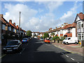
Reigate Road
Residential street linking Millers Road to The Drove that was developed in the late 1880s. The view looks down towards the latter.
Image: © Simon Carey
Taken: 25 Oct 2009
0.01 miles
2
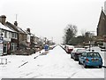
Reigate Road
Residential road that runs between The Drove in the north and Highcroft Villas to the south. Part of the Church of Good Shepherd is visible on the right.
Image: © Simon Carey
Taken: 20 Jan 2013
0.02 miles
3

The Dream Catcher, The Drove
Modern house built next to the junction with Compton Road.
Image: © Simon Carey
Taken: 25 Oct 2009
0.04 miles
4
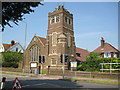
Brighton: The Church of the Good Shepherd, Dyke Road
Built between 1920 and 1922 to the designs of the architect E P Warren, the church is at 272 Dyke Road, and replaced an earlier iron church. Maintenance work on the cross on the roof is evidently in progress.
Image: © Nigel Cox
Taken: 8 Jun 2008
0.05 miles
5

The Drove
One of the steepest hills in the Brighton is often closed to traffic during snow and ice to all vehicles except sledges, a couple of which were bombing down the hill on this day. The road itself is an old droveway that headed west from Preston towards West Blatchington. Most of its course can be made out by following the modern roads called The Drove and The Droveway.
Image: © Simon Carey
Taken: 20 Jan 2013
0.05 miles
6
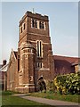
Church of the Good Shepherd
Located in Dyke Road, Brighton, the Grade 2 listed church is built in the Gothic revival style and was completed in 1927 http://www.the-good-shepherd.net/
Image: © Paul Gillett
Taken: 26 Mar 2011
0.05 miles
7
Church of the Good Shepherd
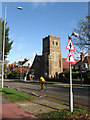
Built between 1920-22 to serve the expanding suburbs on the Brighton side of Dyke Road.
Image: © Simon Carey
Taken: 25 Oct 2009
0.05 miles
8
Shops, The Drove
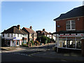
Gemini beauty saloon on one side and a Nokia repair shop on the other of Reigate Road.
Image: © Simon Carey
Taken: 25 Oct 2009
0.05 miles
9
Church of the Good Shepherd
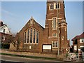
Located in Dyke Road, Brighton, the Grade 2 listed church is built in the Gothic revival style and was completed in 1927 http://www.the-good-shepherd.net/
Image: © Paul Gillett
Taken: 26 Mar 2011
0.05 miles
10

The Drove
The steepest road in Brighton is one way and has its origins as a droving route that headed west from the village of Preston below across what was once downland towards West Blatchington and beyond. Race Hill can be seen in the distance.
Image: © Simon Carey
Taken: 25 Oct 2009
0.05 miles