
IMAGES TAKEN NEAR TO
Providence Place, BRIGHTON, BN1 4UN
Introduction
This page details the photographs taken nearby to Providence Place, BN1 4UN by members of the Geograph project.
The Geograph project started in 2005 with the aim of publishing, organising and preserving representative images for every square kilometre of Great Britain, Ireland and the Isle of Man.

There are currently over 7.5m images from over14,400 individuals and you can help contribute to the project by visiting https://www.geograph.org.uk
Image Map
Images are licensed for reuse under creativecommons.org/licenses/by-sa/2.0
Notes
- Clicking on the map will re-center to the selected point.
- The higher the marker number, the further away the image location is from the centre of the postcode.
Image Listing (517 Images Found)
Images are licensed for reuse under creativecommons.org/licenses/by-sa/2.0
Image
Details
Distance
3
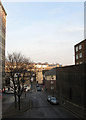
York Hill
Viewed from New England Street which it once joined but was redeveloped in the 1960s and is now a service road for New England House, built in 1962, on the left. Mayflower Court to the right is built on top of small multi-storey car park. The road running left-right as the crossroads is Elder Place to the left and Providence Place to the right. York Hill ends at the junction with London Road.
Image: © Simon Carey
Taken: 11 Jan 2009
0.02 miles
5
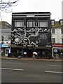
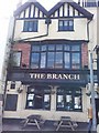
The Worlds End Pub, Brighton
On the London Road near Preston Circus, famous for its BBQ burgers etc https://www.theguardian.com/lifeandstyle/2011/jul/24/jay-rayner-restaurants-bbq-shack
Image: © Paul Gillett
Taken: 1 Mar 2017
0.02 miles
6
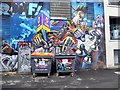
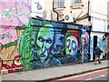
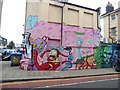
Street Art in Providence Place
And mere graffiti on the wheelie bins.
Image: © Oliver Dixon
Taken: 11 Sep 2019
0.02 miles
7
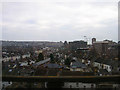
View of Brighton from the viaduct
Taken from the impressive viaduct that carries the railway towards Lewes and Eastbourne, part of which can be seen in the left hand of this picture Image This view looks south east capturing most of the grid square that ends beyond the huge structure of St Bartholomews church. The line of houses to the right are the backs of shops and houses along the A23 northbound only Preston Road. Those to the left the A23southbound only Beaconsfield Road. These join at Preston Circus to the right of the yellow building which is this, Image The modern office buildings on the right were erected in the 1960s when the opld houses built for rail workers were pulled down. The cranes behind are currently developing the site of the old goods yard. The imposing St Bartholomews Church was opened in 1874 and was built to the dimensions of Noah's Ark. It has the tallest roof of any parish church in England. To the left the trees mark out Image The hilly nature of Brighton can be made out in the background with the old workers' terraces now a home for many of the city's students.
Image: © Simon Carey
Taken: 4 Feb 2006
0.02 miles
8
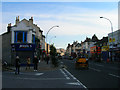
London Road
From the junction with Rose Hill Terrace with a few more veteran cars going past.
Image: © Simon Carey
Taken: 5 Nov 2006
0.02 miles
10
London Road, Brighton
This is the A23 south-east of Preston Circus crossroads.
Image: © Roger D Kidd
Taken: 1 Jan 2015
0.03 miles