
IMAGES TAKEN NEAR TO
Cheapside, BRIGHTON, BN1 4GD
Introduction
This page details the photographs taken nearby to Cheapside, BN1 4GD by members of the Geograph project.
The Geograph project started in 2005 with the aim of publishing, organising and preserving representative images for every square kilometre of Great Britain, Ireland and the Isle of Man.

There are currently over 7.5m images from over14,400 individuals and you can help contribute to the project by visiting https://www.geograph.org.uk
Image Map
Images are licensed for reuse under creativecommons.org/licenses/by-sa/2.0
Notes
- Clicking on the map will re-center to the selected point.
- The higher the marker number, the further away the image location is from the centre of the postcode.
Image Listing (1061 Images Found)
Images are licensed for reuse under creativecommons.org/licenses/by-sa/2.0
Image
Details
Distance
1
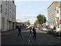
Whitecross Street, Brighton
Linking Trafalgar Street to Cheapside and originally developed in the 1840s after the arrival of the railway. Virtually all of the street was removed around 1962 and subsequently widened which necessitated the removal of the Beehive public house on Trafalgar Street. See http://regencysociety-jamesgray.com/volume25/source/jg_25_238.html for a view from the north. Pelham Tower is on the right.
Image: © Simon Carey
Taken: 25 Oct 2015
0.03 miles
2
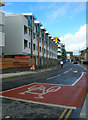
New England Street
The eastern extent of the new New England Quarter development. Until the 1960s this road was actually Fleet Street with New England Street being limited to the northern section between New England Road and York Hill. When the area was redeveloped in the 1960s and the old railway workers houses demolished and replaced with faceless concrete blocks and car parks the whole stretch was renamed New England Street replacing New York Street and Fleet Street the former middle and southern sections respectively. However, the latter has been reprieved and given to the new section to the west which loops around the development. Consequently, the former busy New England Street has seen itself broken into two distinct parts and this section into a quiet back street.
Image: © Simon Carey
Taken: 1 Oct 2006
0.03 miles
3

Solveig and Fuzzcat, Blackman Street
Solveig is the name of a local graffiti artist who has been producing work for the last few years. What makes her different from others is she is currently only eleven which produces a style that is far less aggressive than many other artists of that ilk and far more talented than many other taggers who all seem to share the same type of style. This one was produced a couple of months ago on a board at the north western end of Blackman Street with the help of a younger sister, see http://www.flickr.com/photos/supersolveig/3912155831/
Image: © Simon Carey
Taken: 25 Nov 2009
0.03 miles
4
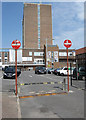
Pelham Tower
Part of City College, the former technical college, which also occupies the old school buildings to the right on Pelham Street. Built in the 1960s partially on the site of Redcross Street much of which is now a car park for the college, though the original intention was to build more college buildings which never materialised. I did my History A level on the seventh floor back in the late 1980s.
Image: © Simon Carey
Taken: 31 Jul 2011
0.03 miles
5
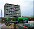
Pelham Tower
Head north to the end of Station Street then south down Cheapside stopping just before the junction with Whitecross Street. This areas experienced slum clearences in the 1960s with most houses in streets north of Trafalgar Street removed. The result is a barren nothing area with warehouses, small businesses, a tower block and this, part of City's Technology College. The tower was opened in 1971.
Click on the link to take you to the next page. http://www.geograph.org.uk/photo/231151
Image: © Simon Carey
Taken: 1 Sep 2006
0.03 miles
6
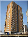
Brighton: Theobald House
Theobald House is a 22 storey Brighton & Hove Council owned residential tower block in Blackman Street. The building is 63 metres high above ground level.
Image: © Nigel Cox
Taken: 8 Jun 2008
0.03 miles
7
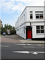
Belmont Street
Built in the 1850s and demolished at the end of the 1960s. this tiny section and buildings on the corner of Cheapside are all what remains.
Image: © Simon Carey
Taken: 31 Jul 2011
0.04 miles
8
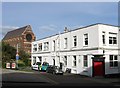
Belmont Street, Brighton
The street once ran from Cheapside to Ann Street and was built in the 1850s and demolished in the late 1960s leaving just number 43 standing. See http://regencysociety-jamesgray.com/volume25/source/jg_25_254.html for a view down the street taken in 1967. Beyond is St Bartolomews church.
Image: © Simon Carey
Taken: 25 Oct 2015
0.04 miles
10
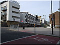
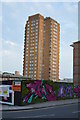
New England Quarter
The New England Quarter is a mixed-use development in the city of Brighton and Hove, England. It was built between 2004 and 2008 on the largest brownfield site in the city, adjacent to Brighton railway station.
More detail: http://en.wikipedia.org/wiki/New_England_Quarter
Image: © Paul Gillett
Taken: 31 Jan 2010
0.04 miles