IMAGES TAKEN NEAR TO
Cross Lane, WORTHING, BN14 0UG
Introduction
This page details the photographs taken nearby to Cross Lane, BN14 0UG by members of the Geograph project.
The Geograph project started in 2005 with the aim of publishing, organising and preserving representative images for every square kilometre of Great Britain, Ireland and the Isle of Man.

There are currently over 7.5m images from over14,400 individuals and you can help contribute to the project by visiting https://www.geograph.org.uk
Image Map
Images are licensed for reuse under creativecommons.org/licenses/by-sa/2.0
Notes
- Clicking on the map will re-center to the selected point.
- The higher the marker number, the further away the image location is from the centre of the postcode.
Image Listing (78 Images Found)
Images are licensed for reuse under creativecommons.org/licenses/by-sa/2.0
Image
Details
Distance
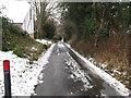
1
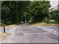
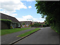
Crossing lanes in Findon
The view is north along Cross Lane. Steep Lane which carries the Monarch's Way crosses here.
Image: © Shazz
Taken: 30 Jul 2010
0.06 miles
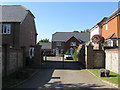
2
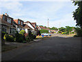
Steep Close
The name of the cul de sac located off High Street and developed in the 1930s partly on the site of a former field called Blackamores Maid Field according to Findon's 1839 tithe map.
Image: © Simon Carey
Taken: 26 Jul 2013
0.06 miles
3
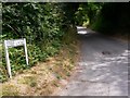
Steep Lane
This is looking east from Cross Lane in Findon. The Monarch's Way uses Steep Lane but the small waymark on the street name is not visible in the photograph.
Image: © Shazz
Taken: 30 Jul 2010
0.06 miles
4
Fox Lea
A cul-de-sac heading east off Cross Lane that was developed in late 1990s on a field called Nepcutt Field according to Findon's 1839 tithe map.
Image: © Simon Carey
Taken: 13 Jul 2013
0.07 miles
6
Sycamore Court
A small private cul de sac off Steep Lane built on the site of a former nursing home.
Image: © Simon Carey
Taken: 8 Jun 2013
0.09 miles
7
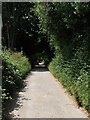
Steep Lane
An old narrow lane in the centre of Findon. This section runs between Cross Lane and High Street.
Image: © Simon Carey
Taken: 13 Jul 2013
0.09 miles
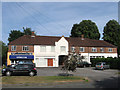
8
The Chase
A small estate built in the mid 1980s on the site of a field once known as the Malt Compiers according to Findon's 1839 tithe map.
Image: © Simon Carey
Taken: 13 Jul 2013
0.11 miles
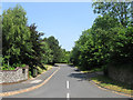
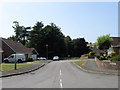
9
Cross Lane
This narrow lane heads into the centre of the village from the A24. To the left is the junction with The Chase.
Image: © Simon Carey
Taken: 2 Jun 2013
0.11 miles
10
The Parade
Located at the southern end of High Street near to the Black Horse and built in the 1930s. The current businesses include a hairdressers, beauty saloon and fitness business.
Image: © Simon Carey
Taken: 26 Jul 2013
0.12 miles