
IMAGES TAKEN NEAR TO
Dyke Road, BRIGHTON, BN1 3JD
Introduction
This page details the photographs taken nearby to Dyke Road, BN1 3JD by members of the Geograph project.
The Geograph project started in 2005 with the aim of publishing, organising and preserving representative images for every square kilometre of Great Britain, Ireland and the Isle of Man.

There are currently over 7.5m images from over14,400 individuals and you can help contribute to the project by visiting https://www.geograph.org.uk
Image Map
Images are licensed for reuse under creativecommons.org/licenses/by-sa/2.0
Notes
- Clicking on the map will re-center to the selected point.
- The higher the marker number, the further away the image location is from the centre of the postcode.
Image Listing (443 Images Found)
Images are licensed for reuse under creativecommons.org/licenses/by-sa/2.0
Image
Details
Distance

2
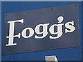
Sign for Fogg's Restaurant, Dyke Road / Bath Street, BN1
See Image
Image: © Mike Quinn
Taken: 16 May 2012
0.01 miles
3
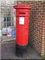
Victorian postbox, Dyke Road / Bath Street, BN1
Image: © Mike Quinn
Taken: 16 May 2012
0.01 miles
4
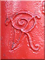
Victorian postbox, Dyke Road / Bath Street, BN1 - royal cipher
See Image
Image: © Mike Quinn
Taken: 16 May 2012
0.01 miles
5

Dyke Road
The original main road heading north out of Brighton viewed from its junction with Seven Dials. The section of the road north and south of the junction is the main shopping area for local residents and includes amongst other things a post office, launderette, barbers, hardware shop, a couple of small Co-op supermarkets and a number of bars and takeaways.
Image: © Simon Carey
Taken: 25 Jan 2014
0.01 miles
6
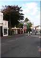
Dyke Road
This view looks north towards its junction with Seven Dials. The area has moved upmarket in the last 10-15 years having once been the archetypal bedsit land with the shops reflecting that change, bistros and cafe bars now in abundance. The building to the right of the white building is a former public convenience that has been converted into two retail units; a florist and a small cafe. The bookmakers may hark back to the area's former lack of glory but the shop beyond the tree, a sushi bar reflects today's clientele.
Image: © Simon Carey
Taken: 26 Aug 2007
0.01 miles
7

cafe one ten, Dyke Road, BN1
Shows the location of Image
Image: © Mike Quinn
Taken: 16 May 2012
0.01 miles
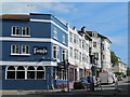
9
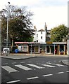
109b-109c, Dyke Road, Brighton
Former 1970s public conveniences converted to retail use sometime in the 1990s viewed from Bath Street.
Image: © Simon Carey
Taken: 25 Oct 2015
0.02 miles
10
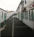
Dyke Road Mews, Brighton
Small workshops in a mews that can be accessed from Dyke Road and Bath Street.
Image: © Simon Carey
Taken: 25 Oct 2015
0.02 miles