IMAGES TAKEN NEAR TO
Victoria Place, BRIGHTON, BN1 3FR

Introduction

This page details the photographs taken nearby to Victoria Place, BN1 3FR by members of the Geograph project.

The Geograph project started in 2005 with the aim of publishing, organising and preserving representative images for every square kilometre of Great Britain, Ireland and the Isle of Man.

There are currently over 7.5m images from over14,400 individuals and you can help contribute to the project by visiting https://www.geograph.org.uk

Image Map


Images are licensed for reuse under creativecommons.org/licenses/by-sa/2.0
Notes
  • Clicking on the map will re-center to the selected point.
  • The higher the marker number, the further away the image location is from the centre of the postcode.

Image Listing (595 Images Found)

Images are licensed for reuse under creativecommons.org/licenses/by-sa/2.0
  • ...
Image
Details
Distance
1
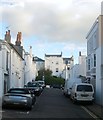
Victoria Place, Brighton
Small residential street that links Montpelier Street to Victoria Street built in the early 1840s. Victoria House on the right obscured by the white vans was built slightly later in the mid 1840s and for some time served as the vicarage to nearby St Michaels and All Angels church.
Image: © Simon Carey Taken: 27 Oct 2017
0.01 miles
2
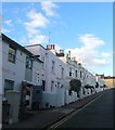
Montpelier Street
Linking Victoria Road with Upper North Street and developed in the 1840s. Bedford Towers, the local Holiday Inn, stands out like a sore thumb in the distance.
Image: © Simon Carey Taken: 30 Jul 2009
0.01 miles
3
Victoria Street, BN1
Image: © Mike Quinn Taken: 16 May 2012
0.02 miles
4
Montpelier Street, BN1
Image: © Mike Quinn Taken: 16 May 2012
0.03 miles
5
23, Montpelier Street, Brighton
Located on the corner of Victoria Road and built in the 1840s as the Temple Inn public house. It remained in use until the 1970s when it was converted into a doctor's surgery. The old door has been bricked up and pretend one painted over meaning the current entrance to the surgery is actually the door on the left. It is possible to walk straight to the seafront from here via Montpelier Street, Hampton Place and Little Preston Street reaching it next to the Holiday Inn whose concrete tower can be seen in the distance.
Image: © Simon Carey Taken: 1 Nov 2015
0.03 miles
6
Victoria Street, Brighton
A residential street linking Upper North Street to Victoria Road that was developed between 1837-41. The shop on the left, Fourcandles, is owned by the daughter of Ronnie Corbett and named after a famous Two Ronnies sketch.
Image: © Simon Carey Taken: 27 Oct 2017
0.03 miles
7
Victoria Road
Head south down Powis Road until you reach a crossroads then turn east into Victoria Road and continue until you reach the junction with Victoria Street. Taken from Victoria Street, the area was developed in the 1840s. The picture also gives some idea of the hilly nature of this area. Click on the link to take you to the next page. http://www.geograph.org.uk/photo/211910
Image: © Simon Carey Taken: 30 Jul 2006
0.03 miles
8
Victoria Street / Victoria Road, BN1
Image: © Mike Quinn Taken: 16 May 2012
0.03 miles
9
Victoria Street, BN1 (2)
Image: © Mike Quinn Taken: 16 May 2012
0.03 miles
10
Montpelier Street, Brighton
Heading south to Upper North Street from Victoria Road. Developed with much of the Clifton Estate around 1845. The brutal concrete monstrosity in the distance is Bedford Towers which also contains the Holiday Inn.
Image: © Simon Carey Taken: 20 Sep 2015
0.03 miles
  • ...