
IMAGES TAKEN NEAR TO
Upper North Street, BRIGHTON, BN1 3FJ
Introduction
This page details the photographs taken nearby to Upper North Street, BN1 3FJ by members of the Geograph project.
The Geograph project started in 2005 with the aim of publishing, organising and preserving representative images for every square kilometre of Great Britain, Ireland and the Isle of Man.

There are currently over 7.5m images from over14,400 individuals and you can help contribute to the project by visiting https://www.geograph.org.uk
Image Map
Images are licensed for reuse under creativecommons.org/licenses/by-sa/2.0
Notes
- Clicking on the map will re-center to the selected point.
- The higher the marker number, the further away the image location is from the centre of the postcode.
Image Listing (894 Images Found)
Images are licensed for reuse under creativecommons.org/licenses/by-sa/2.0
Image
Details
Distance
1
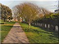
St Nicholas Rest Garden
St Nicholas Rest Garden at the southern end of Dyke Road was laid out in 1840 as an extension cemetery for Brighton's parish church, St Nicholas. It was used for burials until 1853. It is now a city park under the care of the Council and is open to everyone. It provides a green and leafy breathing space not far from the hurly-burly of Western Road. The entrance is through the big stone archway on the opposite side of Dyke Road to the church. http://www.mybrightonandhove.org.uk/category_id__1837_path__0p115p203p.aspx
Image: © Paul Gillett
Taken: 6 Apr 2012
0.01 miles
2
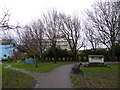
Tent in St Nicholas Gardens
In the UK Brighton has the highest number of homeless people of anywhere outside Londo
Image: © Basher Eyre
Taken: 10 Jan 2016
0.01 miles
3
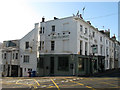
The Florist
Located on the corner of Regent Hill and Upper North Street. I'm pretty certain this used to be known as the Queen Victoria certainly in the 1990s when I spent one or two drunken evenings in here.
Image: © Simon Carey
Taken: 19 Nov 2011
0.02 miles
4
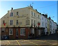
Craft Beer Company, Upper North Street, Brighton
Located on the corner of Regent Hill it was originally the Princess Victoria until the late 2000s when it became The Florist. In 2012 it became the second pub owned by London's Craft Beer Company.
Image: © Simon Carey
Taken: 21 Nov 2015
0.02 miles
6

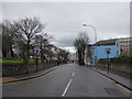
St. Nicholas' Rest Garden, Dyke Road, BN1 (2)
Image: © Mike Quinn
Taken: 25 Apr 2012
0.02 miles
7
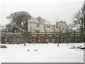
Burial Vaults, St Nicholas Rest Garden
Originally planned by Amon Wilds, the graveyard extension was to contain a huge burial pyramid, a castellated gatehouse and burial vaults. Only the latter were ever built and as the graveyard ceased to be used for burials in 1853 only a few were ever used. There are 14 vaults in total but only one, number 13, has a real door, the rest are fake. Beyond the vaults is Norman House that lies on the corner of Dyke Road and Clifton Terrace.
Image: © Simon Carey
Taken: 18 Jan 2013
0.03 miles
8
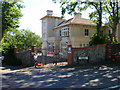
Alternative Centre for Education
Continue north up Dyke Road until you get to the junction with Clifton Terrace. Once known as Norman House I will add more details once I have found them out.
Click on the link to take you to the next page. http://www.geograph.org.uk/photo/212348
Image: © Simon Carey
Taken: 30 Jul 2006
0.03 miles
9

41, Dyke Road, Brighton
The building is built at an angle to the road and was constructed in the 1850s when the road was known as Church Hill. Originally a pub called the Buckingham Arms that operated until around 1905 since when it has been used as a commercial premises of some sort. It is currently an English language school, one of a number that can be found in Brighton.
Image: © Simon Carey
Taken: 27 Oct 2017
0.03 miles
10

Looking from Church Street into Dyke Road
Image: © Basher Eyre
Taken: 10 Jan 2016
0.03 miles