
IMAGES TAKEN NEAR TO
Crown Street, BRIGHTON, BN1 3EH
Introduction
This page details the photographs taken nearby to Crown Street, BN1 3EH by members of the Geograph project.
The Geograph project started in 2005 with the aim of publishing, organising and preserving representative images for every square kilometre of Great Britain, Ireland and the Isle of Man.

There are currently over 7.5m images from over14,400 individuals and you can help contribute to the project by visiting https://www.geograph.org.uk
Image Map
Images are licensed for reuse under creativecommons.org/licenses/by-sa/2.0
Notes
- Clicking on the map will re-center to the selected point.
- The higher the marker number, the further away the image location is from the centre of the postcode.
Image Listing (851 Images Found)
Images are licensed for reuse under creativecommons.org/licenses/by-sa/2.0
Image
Details
Distance

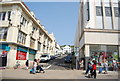
3

44 Upper North Street, Brighton
The three-storey house with the black front was once the Blacksmiths Arms public house which was open from the late 1850s until its closure in 1953. It was converted into a shop but is now a private dwelling though the shop front remains and is used to display artefacts from Anna's Museum. These items have been collected by Anna, still a school child, labelled then placed in the window. The museum is not open to the public but the shop front has proved very popular with those in the locality.
Image: © Simon Carey
Taken: 21 Nov 2015
0.03 miles
4
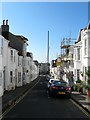
Dean Street, Brighton
A side street linking Upper North Street and Western Road that was developed around the 1820s. The tall structure is the i360 tower which is being constructed on the site of the former West Pier.
Image: © Simon Carey
Taken: 20 Sep 2015
0.03 miles
5
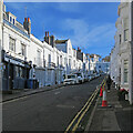
Brighton: up Dean Street
Bright sunlight and deep shadow in one of the steep streets north of Western Road on a fine April morning.
Image: © John Sutton
Taken: 9 Apr 2022
0.03 miles
6
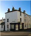
39, Upper North Street, Brighton
Located on the corner of Marlborough Street is a former public house built in the 1830s and converted into a pub around 1850 initially as the Fox but later known as the Old Fox possibly to distinguish itself from at least three other pubs of the same name in town. It closed in 1938 and was converted back into a shop but is now a private residence. See http://regencysociety-jamesgray.com/volume26/source/jg_26_224.html for an image taken in 1924.
Image: © Simon Carey
Taken: 21 Nov 2015
0.03 miles
7

Brighton Seafront - Grand Hotel & Brighton Centre
A photo along the seafront at Brighton looking East from by the West Pier. This photo shows two drastically different buildings, the elegant Grand Hotel (infamous for being bombed by the IRA while Margaret thatcher was attending) and the Brutalist Brighton Centre.
Image: © GaryReggae
Taken: 19 Jul 2003
0.03 miles
8

Regency Square
The NW corner with the Topps Hotel in the centre
Image: © Charles Rawding
Taken: 15 Jun 2004
0.03 miles
9

Rest Gardens, Dyke Road
Head east along Upper North Street then north up Dyke Road the entrance to the gardens is on the west side. Originally built as an extension to St Nicholas' graveyard which is on the western side of Dyke Road and opened in 1841. The rapid rise in population soon forced the local corporation to open two large out of town cemeteries and St Nicholas' was closed down at the end of the nineteenth century. Now it is a public open space.
Click on the link to take you to the next page. http://www.geograph.org.uk/photo/212341
Image: © Simon Carey
Taken: 30 Jul 2006
0.03 miles
