IMAGES TAKEN NEAR TO
Michelgrove, WORTHING, BN13 3XG

Introduction

This page details the photographs taken nearby to Michelgrove, BN13 3XG by members of the Geograph project.

The Geograph project started in 2005 with the aim of publishing, organising and preserving representative images for every square kilometre of Great Britain, Ireland and the Isle of Man.

There are currently over 7.5m images from over14,400 individuals and you can help contribute to the project by visiting https://www.geograph.org.uk

Image Map


Images are licensed for reuse under creativecommons.org/licenses/by-sa/2.0
Notes
  • Clicking on the map will re-center to the selected point.
  • The higher the marker number, the further away the image location is from the centre of the postcode.

Image Listing (36 Images Found)

Images are licensed for reuse under creativecommons.org/licenses/by-sa/2.0
  • ...
Image
Details
Distance
1
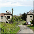
Michelgrove Park Lodges
North Lodge to the left, South Lodge to the right. Built in the early 19th century when Michelgrove Lane was laid out to connect Michelgrove House with the new Longfurlong turnpike which had been sponsored by the owners which enabled them to close the old east-west Lewes to Arundel road which ran parallel to the north.
Image: © Simon Carey Taken: 5 Sep 2013
0.01 miles
2
The Lodges
North Lodge and South Lodge on either side of the road from Michelgrove.
Image: © Chris Thomas-Atkin Taken: 24 Sep 2018
0.01 miles
3
View over Longfurlong
The near buildings on the lane are the Michelgrove Park lodges. It is odd the lodges are there, as the lane continues as a public route right up to Michelgrove. They cannot have a great deal of architectural merit, as the near one has since been heavily extended, and the far one already has.
Image: © Robin Webster Taken: 20 Jun 2010
0.01 miles
4
North and South Lodges on Michelgrove Lane
Image: © Ian Hawfinch Taken: 15 May 2021
0.01 miles
5
Michelgrove Park Lodges
The rear of two lodges, North and South, viewed from Michelgrove Lane. Probably built with the road around 1815 when the owner of Michelgrove House, Richard Watt Walker, opened a new turnpike, the current A280, and built the lane to connect to it. Walker's venture failed and he'd sold the house to the Duke of Norfolk in 1828 who let it fall into disrepair until demolishing it in 1877. The lodges are now private residences.
Image: © Simon Carey Taken: 30 May 2009
0.02 miles
6
Michelgrove Lane NW to Michelgrove Park Lodges
Image: © Dave Spicer Taken: 20 Dec 2009
0.03 miles
7
Twelve Acres
The name of the field according to Patching's 1847 tithe map which includes the various subdivisions in view. Amongst the foliage in the distance is Myrtle Grove Farm.
Image: © Simon Carey Taken: 5 Sep 2013
0.10 miles
8
Approach to Michelgrove
The woods of Michelgrove Park are on the left
Image: © Dave Spicer Taken: 20 Dec 2009
0.13 miles
9
Nine Acres
The name of the field according to Patching's 1847 tithe map that lies between Michelgrove Lane and the slopes of Patching Hill.
Image: © Simon Carey Taken: 5 Sep 2013
0.13 miles
10
Paddocks to the north of Michelgrove Lane
Image: © Ian Hawfinch Taken: 15 May 2021
0.15 miles
  • ...