Michelgrove Park Lodges
Introduction
The photograph on this page of Michelgrove Park Lodges by Simon Carey as part of the Geograph project.
The Geograph project started in 2005 with the aim of publishing, organising and preserving representative images for every square kilometre of Great Britain, Ireland and the Isle of Man.

There are currently over 7.5m images from over 14,400 individuals and you can help contribute to the project by visiting https://www.geograph.org.uk
Michelgrove Park Lodges
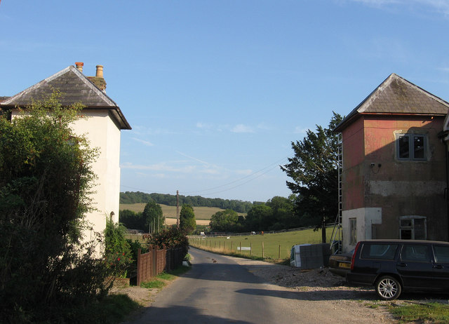
Image: © Simon Carey Taken: 5 Sep 2013
North Lodge to the left, South Lodge to the right. Built in the early 19th century when Michelgrove Lane was laid out to connect Michelgrove House with the new Longfurlong turnpike which had been sponsored by the owners which enabled them to close the old east-west Lewes to Arundel road which ran parallel to the north.
Images are licensed for reuse under creativecommons.org/licenses/by-sa/2.0
Image Location
Latitude
50.858707
Longitude
-0.457811