IMAGES TAKEN NEAR TO
Speedwell Close, WORTHING, BN13 3RX
Introduction
This page details the photographs taken nearby to Speedwell Close, BN13 3RX by members of the Geograph project.
The Geograph project started in 2005 with the aim of publishing, organising and preserving representative images for every square kilometre of Great Britain, Ireland and the Isle of Man.

There are currently over 7.5m images from over14,400 individuals and you can help contribute to the project by visiting https://www.geograph.org.uk
Image Map
Images are licensed for reuse under creativecommons.org/licenses/by-sa/2.0
Notes
- Clicking on the map will re-center to the selected point.
- The higher the marker number, the further away the image location is from the centre of the postcode.
Image Listing (27 Images Found)
Images are licensed for reuse under creativecommons.org/licenses/by-sa/2.0
Image
Details
Distance
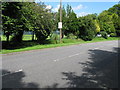
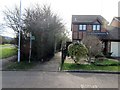
1
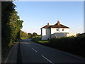
Titnore Lane
Currently an unclassified road but there are ongoing battles with West Sussex County Council who wish to turn it into a new A road, probably the A2700. It has been designated that before but has since been withdrawn with the local roadsigns having this information obscured or removed. Currently a rat run for those living in the western suburbbs of Worthing.
Image: © Simon Carey
Taken: 30 May 2009
0.05 miles
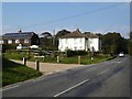
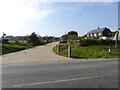
5

Titnore Way
Currently the only road leading onto Titnore Lane and serving the new housing developments of West Durrington which has gradually been creeping towards the lane. Threatened development in nearby Titnore Wood would extend the boundary of the conurbation into the green corridor that separates Worthing from Angmering.
Image: © Simon Carey
Taken: 30 May 2009
0.07 miles
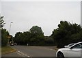
6
Titnore Way Durrington, Worthing
Behind the trees lies a Tennis,Squash and Croquet Club.
Image: © Dave Spicer
Taken: 5 Jul 2012
0.08 miles
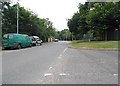
7
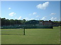
West Worthing Tennis & Squash Club
Close to Titnore Lane and the ancient (and threatened) woodland to the west of Worthing.
Image: © Chris Shaw
Taken: 15 Jun 2005
0.09 miles
9
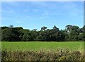
The Hurst Field
The name of the field according to Goring's 1839 tithe map that is bounded by Street's Copse to the north, Titnore Lane to the east and Image to the south beyond the drive to Image
Image: © Simon Carey
Taken: 13 Aug 2017
0.11 miles
10
Batemans Close, BN13 3SA
Public footpath 3114.
Image: © Peter Holmes
Taken: 6 Mar 2015
0.11 miles