IMAGES TAKEN NEAR TO
St. Andrews Close, WORTHING, BN12 5LF
Introduction
This page details the photographs taken nearby to St. Andrews Close, BN12 5LF by members of the Geograph project.
The Geograph project started in 2005 with the aim of publishing, organising and preserving representative images for every square kilometre of Great Britain, Ireland and the Isle of Man.

There are currently over 7.5m images from over14,400 individuals and you can help contribute to the project by visiting https://www.geograph.org.uk
Image Map
Images are licensed for reuse under creativecommons.org/licenses/by-sa/2.0
Notes
- Clicking on the map will re-center to the selected point.
- The higher the marker number, the further away the image location is from the centre of the postcode.
Image Listing (162 Images Found)
Images are licensed for reuse under creativecommons.org/licenses/by-sa/2.0
Image
Details
Distance
1
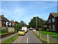
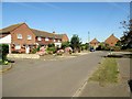
St Andrew's Close, Ferring
A cul de sac off St Maur's Road that was developed in the 1950s. Beyond the end of the road is Image
Image: © Simon Carey
Taken: 13 Aug 2017
0.02 miles
2
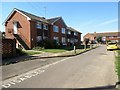
St Andrew's Close, BN12 5LF
Block of flats.
Image: © Peter Holmes
Taken: 24 Aug 2016
0.02 miles
3
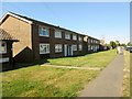
Flats, Onslow Drive, BN12 5RS
Double block of 4 flats.
Image: © Peter Holmes
Taken: 24 Aug 2016
0.03 miles
4
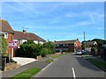
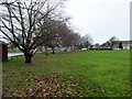
St Maur's Road, Ferring
A residential road that connects Meadow Way to Rife Way that was developed in the 1950s.
Image: © Simon Carey
Taken: 13 Aug 2017
0.04 miles
5
St Maur's Road, BN12 5LE
Public footpath 2113 at junction with St Andrew's Close.
Image: © Peter Holmes
Taken: 24 Aug 2016
0.04 miles
6
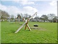
Ferring Village Green
Off Ferring Street, with play equipment and play area.
Image: © Mike Faherty
Taken: 9 Mar 2019
0.05 miles
7
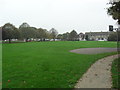
Ferring, recreation ground
Off Rife Way; home to Ferring Football Club.
Image: © Mike Faherty
Taken: 9 Mar 2019
0.05 miles
8
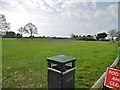
Ferring Village Green
Recently regenerated.
Image: © Burgess Von Thunen
Taken: 24 Oct 2012
0.07 miles
9
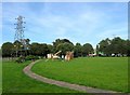
Ferring Village Green, Ferring
On Ferring's 1837 tithe map this was once a field called Vicarage Croft and was later a much larger recreation ground until the development of Rife Way to the south in the 1960s reduced the area. Not sure when the open space was designated a village green but it is fairly recent I believe.
Image: © Simon Carey
Taken: 13 Aug 2017
0.07 miles
10
Ferring Village Green, Rife Way
Tree dressing is an ancient custom which celebrates the beauty and importance of trees.
Image: © Peter Holmes
Taken: 25 Dec 2016
0.07 miles