IMAGES TAKEN NEAR TO
Westlands, WORTHING, BN12 5JQ
Introduction
This page details the photographs taken nearby to Westlands, BN12 5JQ by members of the Geograph project.
The Geograph project started in 2005 with the aim of publishing, organising and preserving representative images for every square kilometre of Great Britain, Ireland and the Isle of Man.

There are currently over 7.5m images from over14,400 individuals and you can help contribute to the project by visiting https://www.geograph.org.uk
Image Map
Images are licensed for reuse under creativecommons.org/licenses/by-sa/2.0
Notes
- Clicking on the map will re-center to the selected point.
- The higher the marker number, the further away the image location is from the centre of the postcode.
Image Listing (110 Images Found)
Images are licensed for reuse under creativecommons.org/licenses/by-sa/2.0
Image
Details
Distance
1
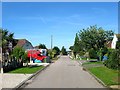
Brook Lane, Ferring
A residential road that heads west from Ferringham Lane and ending at the entrance to Brook Lane Caravan Park. The road follows the course of an old path that continues beyond the entrance to a crossing of Ferring Rife.
Image: © Simon Carey
Taken: 6 Aug 2017
0.05 miles
3
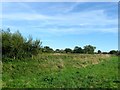
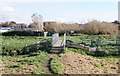
Potwell Mead
The name of the field according to Ferring's 1837 tithe map that is located on the eastern side of Ferring Rife.
Image: © Simon Carey
Taken: 13 Aug 2017
0.07 miles
4

Ferring Rife
Looking north from the bridge
Image: © Josie Campbell
Taken: 26 Jul 2011
0.08 miles
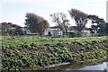
5
East Kingston, footbridge
Across Ferring Rife, on the path from East Kingston.
Image: © Mike Faherty
Taken: 9 Mar 2019
0.08 miles
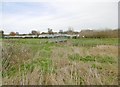
6
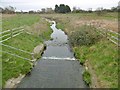
Ferring Rife
Drainage ditch rising in the South Downs and discharging into the sea to the South; looking downstream from Image
Image: © Mike Faherty
Taken: 9 Mar 2019
0.08 miles
7

Footbridge over Rife
This footbridge over the Ferring Rife links Ferring to Kingston.
Image: © Peter Holmes
Taken: 5 Nov 2007
0.09 miles
9
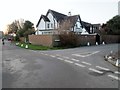
Clover Lane, BN12 5LZ
At junction with Ansisters Road.
Image: © Peter Holmes
Taken: 22 Jan 2017
0.09 miles
10
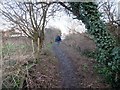
Path to Clover Lane
Public Footpath 2867.
Image: © Peter Holmes
Taken: 22 Jan 2017
0.09 miles