
IMAGES TAKEN NEAR TO
Windsor Street, BRIGHTON, BN1 1RS
Introduction
This page details the photographs taken nearby to Windsor Street, BN1 1RS by members of the Geograph project.
The Geograph project started in 2005 with the aim of publishing, organising and preserving representative images for every square kilometre of Great Britain, Ireland and the Isle of Man.

There are currently over 7.5m images from over14,400 individuals and you can help contribute to the project by visiting https://www.geograph.org.uk
Image Map
Images are licensed for reuse under creativecommons.org/licenses/by-sa/2.0
Notes
- Clicking on the map will re-center to the selected point.
- The higher the marker number, the further away the image location is from the centre of the postcode.
Image Listing (1448 Images Found)
Images are licensed for reuse under creativecommons.org/licenses/by-sa/2.0
Image
Details
Distance
1

DK Rosen, Church Street
Head north up Portland Street then turn west up Church Street. These shops are on south eastern side of Church Street's crossroads with Queens Road. DK Rosen is the second hand clothiers that shut down on the death of the last owner in 2004. It had been a family concern since 1919 and had a reputation for selling good quality second hand suits and jackets.
Click on the link to take you to the next page. http://www.geograph.org.uk/photo/212549
Image: © Simon Carey
Taken: 30 Jul 2006
0.01 miles
2
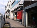
Jessops, Brighton
The Camera Shop went into administration in January 2013
Image: © Paul Gillett
Taken: 17 Jan 2013
0.01 miles
3

Brighton & Hove Albion shop
In Queens Road near the clock tower
Image: © Paul Gillett
Taken: 17 Jan 2013
0.02 miles

5
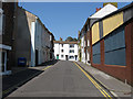
Windsor Street
A side street that lies between North Street and Church Street.
See http://regencysociety-jamesgray.com/volume25/source/jg_25_001.html for a view taken in 1937.
Image: © Simon Carey
Taken: 31 Jul 2011
0.03 miles
6
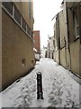
Zion Gardens
Narrow alley that runs parallel to Queen's Road between Air Street and Church Street. The larger building in the distance on the left was built on the site of a former ear and throat hospital.
Image: © Simon Carey
Taken: 18 Jan 2013
0.03 miles
8
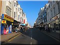
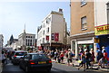
Queen's Road, Brighton
The A2010 between the Clock Tower and Brighton Station. The road was laid out in 1845 to connect the town to the newly opened station though this section between Church Street and Air Street was once the northern section of the latter.
Image: © Simon Carey
Taken: 1 Nov 2015
0.03 miles
10
![Brighton buildings [3]](https://s3.geograph.org.uk/geophotos/07/23/81/7238183_df9bae5e_120x120.jpg)
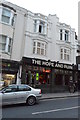
Brighton buildings [3]
The Quadrant public house, numbers 12 and 13 North Street Quadrant, was built in the mid 19th century and altered, including a new front, circa 1900. Constructed of stuccoed brick. Listed, grade II, with details at: https://historicengland.org.uk/listing/the-list/list-entry/1380627
Brighton is a seaside resort and one of the two main areas of the City of Brighton and Hove. Located on the south coast, the city is some 46 miles (76 kilometres) south of London. There is evidence of settlement in the area back to the Bronze Age. The city developed as a health resort, and with the arrival of the railway in 1841, it became a popular destination for day-trippers from London. The city is renowned for the Royal Pavilion and for its pier.
Image: © Michael Dibb
Taken: 9 May 2022
0.03 miles