1
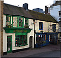
Northern Lights, Little East Street
Originally 2 shops. Late C18 or early C19, combined in 1845. Stucco scored to imitate ashlaring. Roof of tile. Has various been a fishing tackle shop and a tailor's in the past. Grade II listed. The tattoo parlour next door is not a listed buildi and appears to be of later date. Northern Lights is described as a Scandinavian Bar and Kitchen.
Image: © Keith Edkins
Taken: 18 Sep 2016
0.01 miles
2
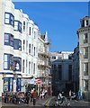
L'Occitane, Brighton
On East Street. With promotional bicycle outside.
A natural beauty products shop. Very, very, very fragrant inside.
Image: © David Anstiss
Taken: 9 Jun 2015
0.01 miles
3
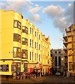
King's Road, Brighton
The road was built in 1821-22 joining together a number of cliff top tracks that necessitated journeys travelling east to west required meandering up and down Ship Street and West Street. This was the eastern end that accessed the main commercial centre of the town via East Street. The road became a back street when Grand Junction Road was completed in 1829 which allowed unhindered travel along the entire seafront from Kemp Town to Brunswick and now forms the A259. Dr Brighton's on the left was built in the 1780s as the Star and Garter Hotel who advertised themselves in the 19th century as Dr Brighton. At the end of the road is the former ABC cinema which opened in 1929 and closed in 2000 and has now been converted into a casino and restaurant. On the right is the northern side of
Image
Image: © Simon Carey
Taken: 11 Oct 2015
0.01 miles
4
Kings Road, Brighton
The eastern end of the road built in the 1820s enabling through access along the coast for the first time. By the end of the decade
Image had been added turning this section into a minor access point to East Street. The pub on the left is Dr Brighton's which dates from the 1780s.
Image: © Simon Carey
Taken: 27 Oct 2017
0.01 miles
5
East Street, Brighton
Looking towards the seafront from the southern edge of The Lanes.
Image: © Stephen McKay
Taken: 11 Dec 2007
0.01 miles
6
Quadrophenia Alley, Brighton
Not officially named as such but known by many for its role in the 1979 film where Phil Daniels and Leslie Ash disappear down the alley behind the door in the distance to partake in some Uganda discussions. The walls are often daubed in graffiti relating to the film but have been recently cleaned. The alley itself runs between East Street and Little East Street.
Image: © Simon Carey
Taken: 20 Sep 2015
0.01 miles
7
Quadrophenia Alley, off East Street, Brighton
This previously nameless little entry has now been named after the film "Quadrophenia" for which it acted as a location. Set in the 1960s in the Mod subculture, the film takes some of its characters from London to Brighton and, whilst riots go on around them, two of them consummate their relationship up this alleyway. Mod graffiti marks it out as a place of Mod pilgrimage (in the "Coasters SC" seen here, SC presumably stands for Scooter Club).
Image: © Christopher Hilton
Taken: 26 Mar 2019
0.01 miles
8
Quadrophenia Alley, off East Street, Brighton
This previously nameless little entry has now been named after the film "Quadrophenia" for which it acted as a location. Set in the 1960s in the Mod subculture, the film takes some of its characters from London to Brighton and, whilst riots go on around them, two of them consummate their relationship up this alleyway. Mod graffiti marks it out as a place of Mod pilgrimage.
Image: © Christopher Hilton
Taken: 26 Mar 2019
0.01 miles
9
East Street, Brighton
Originally the eastern end of Brighton until the late 18th century when the town began to expand. Kings Road is on the left whilst a footpath heads down to Pool valley bus station on the right. The Fishbowl pub on the right dates back to the late 17th century and was originally known as the Blue Anchor until the end of the 18th when it became the Greyhound, a name it retained until the 1990s when it changed to its current one. The street is now closed to traffic on weekends allowing the pub and adjacent cafes to bring tables out onto the street.
Image: © Simon Carey
Taken: 20 Sep 2015
0.02 miles
10
The Fishbowl
On East Street, Brighton. http://www.geograph.org.uk/photo/4808415
Image: © Ian S
Taken: 24 Jan 2016
0.02 miles


