
IMAGES TAKEN NEAR TO
Ashington Gardens, PEACEHAVEN, BN10 8UG
Introduction
This page details the photographs taken nearby to Ashington Gardens, BN10 8UG by members of the Geograph project.
The Geograph project started in 2005 with the aim of publishing, organising and preserving representative images for every square kilometre of Great Britain, Ireland and the Isle of Man.

There are currently over 7.5m images from over14,400 individuals and you can help contribute to the project by visiting https://www.geograph.org.uk
Image Map
Images are licensed for reuse under creativecommons.org/licenses/by-sa/2.0
Notes
- Clicking on the map will re-center to the selected point.
- The higher the marker number, the further away the image location is from the centre of the postcode.
Image Listing (70 Images Found)
Images are licensed for reuse under creativecommons.org/licenses/by-sa/2.0
Image
Details
Distance
1
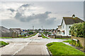
Ashington Gardens
Road at the eastern end of Peacehaven, marked without any houses on the 1928 25 inch map, with subsequent maps showing sporadic building, typical of the random development of Peacehaven.
Image: © Ian Capper
Taken: 21 May 2024
0.02 miles
2
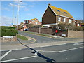
Downland Avenue, Peacehaven, East Sussex
Image: © Stacey Harris
Taken: 2 Mar 2009
0.04 miles
3
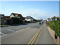
South Coast Road (A259), Peacehaven, East Sussex
Image: © Stacey Harris
Taken: 2 Mar 2009
0.05 miles
4
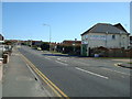
South Coast Road (A259), Peacehaven, East Sussex
Image: © Stacey Harris
Taken: 2 Mar 2009
0.05 miles
5
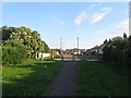
Searle Avenue
Not part of the original 1920s layout of Peacehaven, the road was added towards the end of the 1950s and initially ran between South Coast Road, the A259, and Arundel Road. Both ends have now been closed off meaning access can only be made via Ashington Gardens. Unlike many of the original roads which were straight this one has a slight kink in it a result of it following an old field boundary.
Image: © Simon Carey
Taken: 6 Jul 2012
0.05 miles
7
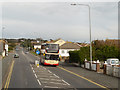
Sir Arthur Newsholme at Peacehaven
Brighton and Hove Bus Company's bus number 728, a Scania Omnicity in the red and white “Coaster” livery and carrying the name "Sir Arthur Newsholme*", on South Coast Road at Peacehaven.
*Sir Arthur Newsholme was Brighton’s first Medical Officer of Health in 1888.
(http://history.buses.co.uk/history/fleethist/728an.htm Brighton & Hove Bus Company)
Image: © David Dixon
Taken: 5 Aug 2012
0.06 miles
8
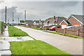
Ashington Gardens
Road at the eastern end of Peacehaven, marked without any houses on the 1928 25 inch map, with subsequent maps showing sporadic building, typical of the random development of Peacehaven.
Image: © Ian Capper
Taken: 21 May 2024
0.07 miles
9
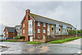
Downlands Court
Retirement flats between Roundhay Avenue, Downland Avenue and Cissbury Avenue, built in 2013.
Image: © Ian Capper
Taken: 21 May 2024
0.08 miles
10
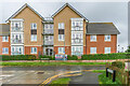
Downlands Court
Retirement flats between Roundhay Avenue, Downland Avenue and Cissbury Avenue, built in 2013.
Image: © Ian Capper
Taken: 21 May 2024
0.08 miles