IMAGES TAKEN NEAR TO
Mayfield Avenue, PEACEHAVEN, BN10 8PB
Introduction
This page details the photographs taken nearby to Mayfield Avenue, BN10 8PB by members of the Geograph project.
The Geograph project started in 2005 with the aim of publishing, organising and preserving representative images for every square kilometre of Great Britain, Ireland and the Isle of Man.

There are currently over 7.5m images from over14,400 individuals and you can help contribute to the project by visiting https://www.geograph.org.uk
Image Map
Images are licensed for reuse under creativecommons.org/licenses/by-sa/2.0
Notes
- Clicking on the map will re-center to the selected point.
- The higher the marker number, the further away the image location is from the centre of the postcode.
Image Listing (32 Images Found)
Images are licensed for reuse under creativecommons.org/licenses/by-sa/2.0
Image
Details
Distance
2
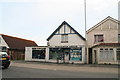
Fishing shop on the South Coast Road through Peacehaven
Image: © Chris
Taken: 11 Jun 2016
0.08 miles
3
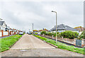
Slindon Avenue
Looking along Slindon Avenue from the clifftop road, Promenade.
Image: © Ian Capper
Taken: 21 May 2024
0.09 miles
4
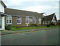
Peacehaven Evangelical Free Church
Peacehaven Evangelical Free Church, as it is known today, had its origins in open air meetings on the promenade in Joslin's Pit near Seaview Avenue, which has since disappeared due to coastal erosion. The original church was opened in 1922 using a building that had started life on Seaford Head as an accommodation hut for troops during the Great War. A new brick built church was constructed and opened in 1966. The original building was taken into use as a church hall and remained in service until 2002 by which time it had deteriorated so much it had to be demolished. In 2005 the new Friendship Centre offering a self contained flat, a sports hall and a kitchen, together with function and meeting rooms was opened behind the main church. https://www.pefc.org.uk/history-of-pefc/
Image: © Gerald England
Taken: 27 Apr 2017
0.09 miles
5
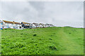
Clifftop open space
Clifftop open space alongside Neville Road.
Image: © Ian Capper
Taken: 21 May 2024
0.09 miles
6
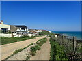
Promenade at Peacehaven
Slindon Avenue is the first turning on the left and beyond that is Mayfield Avenue, followed by one of the long stretches of grass which characterise the cliff top at Peacehaven. The nearest white cliffs are at Harbour Heights, this side of Newhaven while in the very far distance is Seaford Head.
Image: © Marathon
Taken: 5 Jun 2021
0.10 miles
7
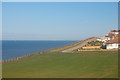
Clifftop Walk, Peacehaven
Taken from behind houses in Neville Road.
Image: © Trevor Harris
Taken: 26 Aug 2012
0.10 miles
8
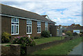
Peacehaven Evangelical Church, South Coast Road, Peacehaven
Image: © Kevin Gordon
Taken: 20 Jul 2008
0.10 miles