
IMAGES TAKEN NEAR TO
Keymer Avenue, PEACEHAVEN, BN10 8EX
Introduction
This page details the photographs taken nearby to Keymer Avenue, BN10 8EX by members of the Geograph project.
The Geograph project started in 2005 with the aim of publishing, organising and preserving representative images for every square kilometre of Great Britain, Ireland and the Isle of Man.

There are currently over 7.5m images from over14,400 individuals and you can help contribute to the project by visiting https://www.geograph.org.uk
Image Map
Images are licensed for reuse under creativecommons.org/licenses/by-sa/2.0
Notes
- Clicking on the map will re-center to the selected point.
- The higher the marker number, the further away the image location is from the centre of the postcode.
Image Listing (30 Images Found)
Images are licensed for reuse under creativecommons.org/licenses/by-sa/2.0
Image
Details
Distance
1
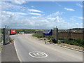
Entrance to Peacehaven Wastewater Treatment Works
Still in the process of construction and part of a huge series of drainage works designed for the treatment of Brighton's waste water. The development has been nine years in the planning and involved a number of legal battles against the local residents who were against the scheme and dubbed it 'Poohaven'. The works have been built and have been covered with a grass turf roof that is curved to enable it to fit into the local landscape.
Image: © Simon Carey
Taken: 9 Jun 2012
0.08 miles
2
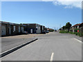
Bolney Avenue
Well it was but there does seem to be a confusion of whether it still is. The road is one of the original highways laid out in 1920 with this section initially used as an access track to Lower Hoddern, a small farm predating the development of the town. Since the 1990s the section in the distance beyond the bollards has become Rayford Close whilst the part to the north is now only accessed via Image Beyond the works to the left is Iroko House which still gives its address as Bolney Avenue.
Image: © Simon Carey
Taken: 9 Jun 2012
0.10 miles
3
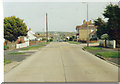
Arundel Road, Peacehaven
Peacehaven was built as a planned suburb on a grid system, but has no roads off Arundel Road here which lead anywhere, they all end on the hills on the South Downs.
Image: © David Howard archives
Taken: Unknown
0.13 miles
4
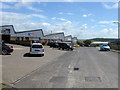
Hoyle Road
Part of the meridian Industrial Estate built in the early 1980s. The road was originally a dead end but has now been extended to include access to the new sewage works on the outskirts of Peacehaven.
Image: © Simon Carey
Taken: 9 Jun 2012
0.15 miles
5

Corner, the Sports Park, Peacehaven
The game was between Peacehaven and Telscombe United and East Grinstead Town. The home team in white won the match by four goals to one.
Image: © nick macneill
Taken: 4 Aug 2012
0.16 miles
6
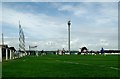
Football match, The Sports Park, Peacehaven
The game was between Peacehaven and Telscombe United and East Grinstead Town. The home team in white won the match by four goals to one.
Image: © nick macneill
Taken: 4 Aug 2012
0.17 miles
7
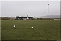
The Sports Park
The home of Peacehaven & Telscombe FC. Herring Gulls patrol the pitch in the drizzle before the afternoon's football begins.
Image: © Martin Addison
Taken: 28 Feb 2015
0.17 miles
8
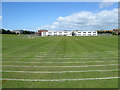
Playing Fields, Peacehaven Community School
The fields are the site of an old small farm called Lower Hoddern which existed before the development of Peacehaven and survived into the 1950s before moving to its current site less than a mile to the north. The school was opened in 2001 after years of campaigns for a local secondary school, the local council striking a deal with a property to company to build it in return for land to build houses.
Image: © Simon Carey
Taken: 9 Jun 2012
0.17 miles
9
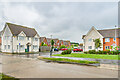
Gladys Avenue
Extension of Gladys Avenue north of Arundel Road, completed c.2015.
Image: © Ian Capper
Taken: 21 May 2024
0.17 miles
10
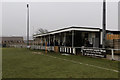
The Sports Park
The clubhouse and changing rooms complex at Peacehaven & Telscombe FC's ground.
Image: © Martin Addison
Taken: 28 Feb 2015
0.18 miles