
IMAGES TAKEN NEAR TO
Valley Road, PEACEHAVEN, BN10 8AJ
Introduction
This page details the photographs taken nearby to Valley Road, BN10 8AJ by members of the Geograph project.
The Geograph project started in 2005 with the aim of publishing, organising and preserving representative images for every square kilometre of Great Britain, Ireland and the Isle of Man.

There are currently over 7.5m images from over14,400 individuals and you can help contribute to the project by visiting https://www.geograph.org.uk
Image Map
Images are licensed for reuse under creativecommons.org/licenses/by-sa/2.0
Notes
- Clicking on the map will re-center to the selected point.
- The higher the marker number, the further away the image location is from the centre of the postcode.
Image Listing (17 Images Found)
Images are licensed for reuse under creativecommons.org/licenses/by-sa/2.0
Image
Details
Distance
1

Halcombe Farm
Viewed from the bridleway that heads to Telscombe village. The barn in the foreground and the driveway are in this square, those beyond are in the next square. The northern edge of Peacehaven can be seen on the brow of the hill.
Image: © Simon Carey
Taken: 26 Dec 2008
0.03 miles
2

Barn, Halcombe Farm
The barn may be modern but the farm itself is quite old.
Image: © Simon Carey
Taken: 9 Jun 2012
0.05 miles
3

Harcombe Old Cinque Foil
The name of the field according to Piddinghoe's 1843 tithe map that lies on the northern slope of Lodge Hill. Halcombe Farm is visible in the valley below and Harcombe is a version of that name. Cinquefoil literally means five leafed and is most likely named after a plant grown or a flower that grew on downland. Bullock Down is to the left whilst Itford Hill is visible in the distance.
Image: © Simon Carey
Taken: 2 Jun 2012
0.10 miles

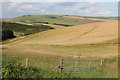
6

The Lookout
The last house on this part of the unmade road, beyond that the bridleway continues onto Piddinghoe.
Image: © Simon Carey
Taken: 26 Dec 2008
0.19 miles
7
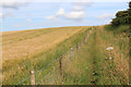
Footpath from Telscombe Road
Barley field near Halcombe Farm
Image: © Oast House Archive
Taken: 21 Jul 2012
0.19 miles
8
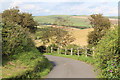
Telscombe Road
Private road to Halcombe Farm.
Image: © Oast House Archive
Taken: 21 Jul 2012
0.20 miles
9
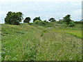
Footpath to Telscombe Road
Quite a well-used path, but hidden by the vigorous growth of grass.
Image: © Robin Webster
Taken: 26 Jun 2013
0.21 miles
10

Downland between Peacehaven and Piddinghoe
Following the bridleway as it heads east. The small valley to the right contains Halcombe Farm. The village in the distance is Tarring Neville with the chalkpit to the right. South Heighton and Denton can also be made out
Image: © Simon Carey
Taken: 25 Dec 2005
0.21 miles