
IMAGES TAKEN NEAR TO
Cavell Avenue, PEACEHAVEN, BN10 7NS
Introduction
This page details the photographs taken nearby to Cavell Avenue, BN10 7NS by members of the Geograph project.
The Geograph project started in 2005 with the aim of publishing, organising and preserving representative images for every square kilometre of Great Britain, Ireland and the Isle of Man.

There are currently over 7.5m images from over14,400 individuals and you can help contribute to the project by visiting https://www.geograph.org.uk
Image Map
Images are licensed for reuse under creativecommons.org/licenses/by-sa/2.0
Notes
- Clicking on the map will re-center to the selected point.
- The higher the marker number, the further away the image location is from the centre of the postcode.
Image Listing (55 Images Found)
Images are licensed for reuse under creativecommons.org/licenses/by-sa/2.0
Image
Details
Distance
1
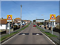
Roderick Avenue
This section of the road links Arundel Road to South Coast Road though the latter has now been closed off to traffic. Originally the main road to the northern edge of Peacehaven it was superseded in the late 1970s when the construction of the Meridian Centre when it was easier to widen Sutton Avenue than this road. The building on the right in the distance is Peacehaven Infants School given a rebuild in the 1990s as a deal between the council and a developer wishing to build more houses, the former allowing the latter only if they upgrade all the local junior schools and build a much needed new secondary school.
Image: © Simon Carey
Taken: 15 Mar 2009
0.05 miles
2
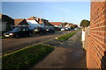
Greenwich Meridian in Roderick Avenue
This picture was taken standing on the Bradley Greenwich meridian looking North. The Bradley meridian passes straight through the middle, see this http://www.riddlerworld.co.uk/meridian/PG0124.htm for an alternate image with the meridian superimposed as a green line. Here the meridian diagonally crosses Roderick Avenue. The picture was taken with my back to Peacehaven Infants School which also has a mosaic on the ground near its front entrance marking the path of the Meridian. See this http://www.thegreenwichmeridian.org/tgm/location.php?i_latitude=50.793453&i_type=
Image: © steve ridley
Taken: 8 Dec 2010
0.06 miles
3
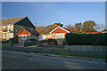
Greenwich Meridian crossing Arundel Rd
This picture was taken standing on the Bradley Greenwich meridian looking North. The meridian passes straight through the middle, see this http://www.riddlerworld.co.uk/meridian/PG0132.htm for an alternate image with the meridian superimposed as a green line. The meridian crosses Arundel Rd and goes straight through a bungalow in this picture.
Image: © steve ridley
Taken: 8 Dec 2010
0.07 miles
5
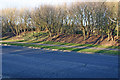
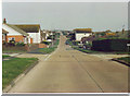
Greenwich Meridian crossing Greenwich Way
Although this road is called “Greenwich Way” and opposite is “Meridian Park” there is no indication of exactly where the Meridian passes. This picture was taken standing on the Bradley Greenwich meridian looking North. The Greenwich Meridian passes straight through the middle, see this http://www.riddlerworld.co.uk/meridian/PG0140.htm for an alternate image with the meridian superimposed as a green line. The meridian cuts Greenwich Way and then continues north through the trees of Meridian Park. It’s not going to win POTY but it’s all about the position.
Image: © steve ridley
Taken: 30 Jan 2011
0.10 miles
6
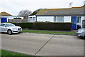
Greenwich Meridian crossing an unnamed road
This picture was taken standing on the Bradley Greenwich meridian looking North. The meridian passes straight through the middle, see this http://www.riddlerworld.co.uk/meridian/PG0110.htm for an alternate image with the meridian superimposed as a green line. Here the Bradley meridian crosses an unnamed road that links Edith Avenue and Roderick Avenue in Peacehaven. The road has no name on any mapping web sites and has no houses actually facing it.
Image: © steve ridley
Taken: 23 Jan 2011
0.11 miles
7

Sutton Avenue, Peacehaven
Looking into Sutton Avenue from the busy roundabout on the A259.
Image: © Stephen McKay
Taken: 28 May 2026
0.13 miles
10

The Dell, Peacehaven
The Dell is an area of open land between the A259 and the clifftop. Peacehaven Town Council describes it as a venue for 'car boot sales, fairs, shows and recreational activities'. In the years before the Second World War there was a cinema on the site but it was destroyed by a fire in 1940 caused by a faulty projector; there were no casualties but the cinema was never rebuilt.
Image: © Stephen McKay
Taken: 28 May 2026
0.15 miles