
IMAGES TAKEN NEAR TO
South Coast Road, PEACEHAVEN, BN10 7EW
Introduction
This page details the photographs taken nearby to South Coast Road, BN10 7EW by members of the Geograph project.
The Geograph project started in 2005 with the aim of publishing, organising and preserving representative images for every square kilometre of Great Britain, Ireland and the Isle of Man.

There are currently over 7.5m images from over14,400 individuals and you can help contribute to the project by visiting https://www.geograph.org.uk
Image Map
Images are licensed for reuse under creativecommons.org/licenses/by-sa/2.0
Notes
- Clicking on the map will re-center to the selected point.
- The higher the marker number, the further away the image location is from the centre of the postcode.
Image Listing (76 Images Found)
Images are licensed for reuse under creativecommons.org/licenses/by-sa/2.0
Image
Details
Distance
1
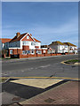
Roclyns, South Coast Road, Telscombe Cliffs
A nursing home on the corner of the A259 and Ambleside Avenue. The three big houses date back to the late 1920s and the smaller bungalow being built as an infill at a later date. At least two of the houses have been bed & breakfasts at some point in their life.
Image: © Simon Carey
Taken: 15 Mar 2009
0.04 miles
2
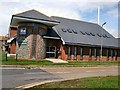
Telscombe Cliffs Civic Centre
Base of Telscombe Town Centre on the South Coast Road (A259)
Image: © Paul Gillett
Taken: 14 Jul 2012
0.04 miles
3
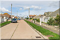
Lincoln Avenue South
Residential road in Peacehaven.
Image: © Ian Capper
Taken: 20 Sep 2022
0.05 miles
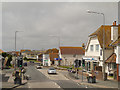
5
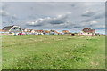
The Esplanade
Clifftop grassy area with houses in The Esplanade on the left.
Image: © Ian Capper
Taken: 20 Sep 2022
0.08 miles
6
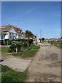
Cairo Avenue South
One of two roads left in the town unmade, the other being Hoddern Avenue South. From its inception in 1916 up to 1958 when the town came under the local district council pretty much all roads other than the A259 resembled this. The road itself links The Promenade with the A259 South Coast Road.
Image: © Simon Carey
Taken: 15 Mar 2009
0.08 miles
7
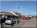
Yeomans, Ambleside Avenue, Telscombe Cliffs
Used car salesroom on the corner of Ambleside Avenue and South Coast Road, the A259. Converted in the 1980s from a former dairy. Ambleside Avenue runs from the cliff top north to Heathy Brow.
Image: © Simon Carey
Taken: 15 Mar 2009
0.08 miles
8
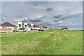
The Esplanade
Clifftop grassy area with houses in The Esplanade on the left.
Image: © Ian Capper
Taken: 20 Sep 2022
0.09 miles
9
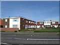
Channel Grange, South Coast Road, Telscombe Cliffs
Built in the 1960s as part of infilling undertaken by Lewes District Council to give some sort of form to the towns of Peacehaven and Telscombe. Both had been developed from the end of the First World War by selling individual plots often without basic utilities on unmade roads. Their piecemeal development was partially responsible for the 1947 Town Planning Act and it was only from 1958 onwards that both towns came under the district council's responsibility who in turn began focusing on developing the town as a whole starting with the metalling of the roads, the supply of basic utilities and filling in the large gaps between previously developed individual plots.
Image: © Simon Carey
Taken: 15 Mar 2009
0.09 miles
10
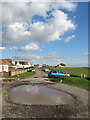
The Esplanade, Telscombe Cliffs
An unmade road that runs across the cliff top from the car park at Fairlight Avenue to the border with Peacehaven which can be made out in the distance by the southward extension of the building line that runs up to the edge of the cliffs. This view is from the junction with Central Avenue and the green to the right is the last remnant of a field called East Cliff Laine according to Telscombe's 1842 tithe map. The old field extended up to what is now the A259 and now lies under the buildings of the southern part of Central and Ambleside Avenues.
Image: © Simon Carey
Taken: 14 Oct 2012
0.09 miles