IMAGES TAKEN NEAR TO
South Coast Road, PEACEHAVEN, BN10 7EU
Introduction
This page details the photographs taken nearby to South Coast Road, BN10 7EU by members of the Geograph project.
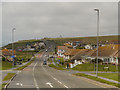
The Geograph project started in 2005 with the aim of publishing, organising and preserving representative images for every square kilometre of Great Britain, Ireland and the Isle of Man.

There are currently over 7.5m images from over14,400 individuals and you can help contribute to the project by visiting https://www.geograph.org.uk
Image Map
Images are licensed for reuse under creativecommons.org/licenses/by-sa/2.0
Notes
- Clicking on the map will re-center to the selected point.
- The higher the marker number, the further away the image location is from the centre of the postcode.
Image Listing (81 Images Found)
Images are licensed for reuse under creativecommons.org/licenses/by-sa/2.0
Image
Details
Distance
1

Wimpy by night, Telscombe Cliffs
Q magazine announced in the year 2000 that proof that Britain was not ready for the new millennium was due to the continual existence of the Wimpy Bar. Well, they are still here!
Image: © nick macneill
Taken: 7 Dec 2012
0.01 miles
2
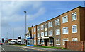
Conservative Party offices, Telscombe Cliffs
Image: © nick macneill
Taken: 23 Sep 2011
0.02 miles
3
Tommy Cook at Telscombe
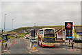
Brighton and Hove Bus Company's fleet number 623, a Scania Omnidekka carrying the name of "Tommy Cook" who is the record goal scorer in the history of Brighton and Hove Albion FC http://history.buses.co.uk/history/fleethist/623tc.htm . It is seen here near the Texaco garage at Telscombe Cliff on the A259.
Image: © David Dixon
Taken: 5 Aug 2012
0.03 miles
4

Telscombe Cliffs Way, Peacehaven
This is a very impressive road for a cul de sac.
Image: © David Howard archives
Taken: Unknown
0.05 miles
5

The Esplanade, Telscombe Cliffs
The Esplanade is an unmade road at Telscombe Cliffs, on the Sussex coast. This image was taken in July 2022, after some hot weather and a prolonged period without rain. The ground was very dry and the grass had turned yellow.
Image: © Malc McDonald
Taken: 24 Jul 2022
0.05 miles
7

The Esplanade at Telscombe Cliffs
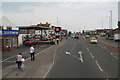
The bungalow in the far distance is the very last one at the western end of Peacehaven. This is Telscombe Cliffs and shows one of the long stretches of grass which characterise the cliff top at Peacehaven and Telscombe Cliffs.
Image: © Marathon
Taken: 5 Jun 2021
0.05 miles
8
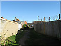
Alley, Telscombe Cliffs
Running between Fairlight Avenue and Telscombe Cliffs Way. This section in view runs behind the Texaco garage that faces onto South Coast Road.
Image: © Simon Carey
Taken: 27 Oct 2012
0.06 miles
9

The Esplanade, Telscombe Cliffs
An unmade road that runs along the cliff top at Telscombe Cliffs from the boundary with Peacehaven to the car park at Fairlight Avenue.
Image: © Simon Carey
Taken: 14 Oct 2012
0.06 miles