IMAGES TAKEN NEAR TO
Mount Pleasant, BOLTON, BL3 1RZ

Introduction

This page details the photographs taken nearby to Mount Pleasant, BL3 1RZ by members of the Geograph project.

The Geograph project started in 2005 with the aim of publishing, organising and preserving representative images for every square kilometre of Great Britain, Ireland and the Isle of Man.

There are currently over 7.5m images from over14,400 individuals and you can help contribute to the project by visiting https://www.geograph.org.uk

Image Map


Images are licensed for reuse under creativecommons.org/licenses/by-sa/2.0
Notes
  • Clicking on the map will re-center to the selected point.
  • The higher the marker number, the further away the image location is from the centre of the postcode.

Image Listing (31 Images Found)

Images are licensed for reuse under creativecommons.org/licenses/by-sa/2.0
  • ...
Image
Details
Distance
1
The Volunteer
Image: © David Dixon Taken: 14 Feb 2010
0.05 miles
2
Road junction
Hacken Lane meets Radcliffe Road.
Image: © philandju Taken: 17 Apr 2022
0.05 miles
3
Hacken Lane meets Radcliffe Road
Image: © Bradley Michael Taken: 15 Sep 2015
0.06 miles
4
Smithy Bridge
Bridge over the former course of the Manchester, Bolton & Bury Canal.
Image: © David Dixon Taken: 2 Jan 2011
0.10 miles
5
Moses Gate Country Park
The northern access to Moses Gate Country Park, following the former course of the Manchester, Bolton & Bury Canal, at Smithy Bridge.
Image: © David Dixon Taken: 2 Jan 2011
0.13 miles
6
Darcy Lever Cricket Club - Scoreboard
Darcy Lever CC run two teams in the Bolton & District Cricket Association and a third team in the North Manchester Cricket League.
Image: © BatAndBall Taken: 3 Jun 2012
0.13 miles
7
Top 'o the Gorses Darcy Lever
A view from the top of the steps looking down toward Lever Bridge
Image: © Jim Naughton Taken: 22 Jan 2010
0.14 miles
8
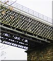
Darcy Lever railway viaduct
When this viaduct was rebuilt with stronger more modern steelwork spans, the two outer spans were retained. They show the more intricate - and more expensive - lattice work, which was the limit of technology in the latter 1800s
Image: © Flying Stag Taken: 13 Apr 2011
0.15 miles
9
Viaduct, Lever Bridge
Image: © John Lord Taken: 26 Dec 2012
0.16 miles
10
Lever Bridge, Bolton
The area takes its name from the road bridge over the River Tonge. The pub on the right is the Lever Bridge. The iron and stone viaduct once carried the railway line to Bradley Fold and Bury. This line ran by the top of the embankment end at Burnden Park - once the home of Bolton Wanderers F.C. It was not unknown for goods train engine drivers to halt above the embankment on match days for a free view of the game.
Image: © philandju Taken: 19 Dec 2013
0.16 miles
  • ...