IMAGES TAKEN NEAR TO
Ennerdale Gardens, BOLTON, BL2 5HH
Introduction
This page details the photographs taken nearby to Ennerdale Gardens, BL2 5HH by members of the Geograph project.
The Geograph project started in 2005 with the aim of publishing, organising and preserving representative images for every square kilometre of Great Britain, Ireland and the Isle of Man.

There are currently over 7.5m images from over14,400 individuals and you can help contribute to the project by visiting https://www.geograph.org.uk
Image Map
Images are licensed for reuse under creativecommons.org/licenses/by-sa/2.0
Notes
- Clicking on the map will re-center to the selected point.
- The higher the marker number, the further away the image location is from the centre of the postcode.
Image Listing (13 Images Found)
Images are licensed for reuse under creativecommons.org/licenses/by-sa/2.0
Image
Details
Distance
1
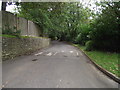
Bailey Lane, Breightmet, Bolton
An old lane now amidst a council estate.
Image: © philandju
Taken: 23 Sep 2011
0.06 miles
2
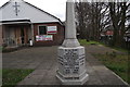
War Memorial at Breightmet
The memorial was originally in the yard of Breightmet United Reformed Church in Bury Road, Bolton. When that church closed in the 1990s the memorial was removed to Astley Bridge British Legion Club for safe keeping. The memorial has now been returned to Breightmet and stands in the grounds of Red Lane United Reformed Church in Newby Road. The memorial was re-dedicated in a ceremony carried out on Sunday 21st April 2013. The memorial seems to be missing an original top piece - perhaps a cross - but whether that is the case or not I do not know.
Image: © philandju
Taken: 22 Apr 2013
0.11 miles
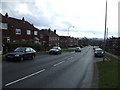
3
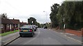
Red Lane, Breightmet, Bolton
On the right, substantial inter-wars semi-detached houses, and on the left, old folks' council bungalows, built in the 1960's.
Image: © philandju
Taken: 23 Sep 2011
0.14 miles
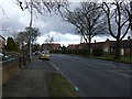
4
Strathmore Road, Breightmet, Bolton
A short cul-de-sac of pre second world war semi detached houses, once semi rural and now amidst a council estate.
Image: © philandju
Taken: 23 Sep 2011
0.15 miles
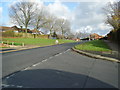
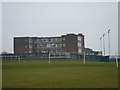
6
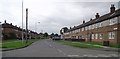
Council housing in Breightmet, Bolton
Kentmere Road. Part of a large council estate built around the 1960's.
Image: © philandju
Taken: 23 Sep 2011
0.20 miles
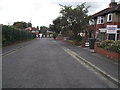
7

Houses on Red Lane
Semi detached houses, probably built between the wars.
Image: © philandju
Taken: 3 Aug 2021
0.20 miles