IMAGES TAKEN NEAR TO
Roading Brook Road, BOLTON, BL2 4JD
Introduction
This page details the photographs taken nearby to Roading Brook Road, BL2 4JD by members of the Geograph project.
The Geograph project started in 2005 with the aim of publishing, organising and preserving representative images for every square kilometre of Great Britain, Ireland and the Isle of Man.

There are currently over 7.5m images from over14,400 individuals and you can help contribute to the project by visiting https://www.geograph.org.uk
Image Map
Images are licensed for reuse under creativecommons.org/licenses/by-sa/2.0
Notes
- Clicking on the map will re-center to the selected point.
- The higher the marker number, the further away the image location is from the centre of the postcode.
Image Listing (31 Images Found)
Images are licensed for reuse under creativecommons.org/licenses/by-sa/2.0
Image
Details
Distance
1
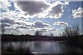
Pond at The Height
Still slightly frozen despite afternoon sun.
Image: © philandju
Taken: 13 Mar 2013
0.03 miles
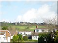
2
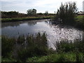
Pond at The Height
Originally a farmhouse and outbuildings, The Height is now converted into half a dozen substantial residences. "No Fishing" notices are posted at the pond's edge.
Image: © philandju
Taken: 27 Sep 2011
0.05 miles
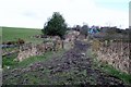
4
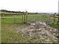
Muddy gateway at The Height
The pedestrian gateway is not for fatties!
Image: © philandju
Taken: 1 Dec 2013
0.08 miles
5
The Height from Davenport Fold Road
The Height is a farmhouse now converted into several dwellings.
Image: © philandju
Taken: 3 Feb 2016
0.09 miles
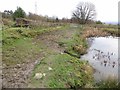
6
Footpath to Bowstone Hill
Leading, muddily, from The Height to Bowstone Hill.
Image: © philandju
Taken: 13 Mar 2013
0.11 miles
7
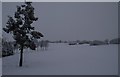
Snow covered fairway
Harwood golf course.
Image: © philandju
Taken: 14 Jan 2013
0.11 miles
8
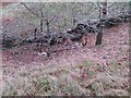
Abandoned farm machinery
It is difficult to identify, but possibly a harrow.
Image: © philandju
Taken: 1 Dec 2013
0.12 miles
9
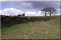
Dry stone wall near The Height
Built with a flatter cut of stone than is the norm for these parts.
Image: © philandju
Taken: 13 Mar 2013
0.12 miles
10
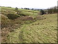
Footpath through the fields
The path leads from Old Holts on Harwood Road, along by The Height and on to Asmus Fold on Brookfold Lane.
Image: © philandju
Taken: 1 Dec 2013
0.12 miles